USGS home - www.usgs.gov
Coastal and Marine Geology Program homepage - marine.usgs.gov
  U. S. Geological Survey Open-File Report 01-154
 

thumbnail view showing Canada shapefile
Canada data overlay shown in gray

Canada data layer

Metadata:


Identification_Information:
Citation:
Citation_Information:
Originator: Valerie Paskevich(ed.)
Publication_Date: 20010331
Title: Canada shapefile
Geospatial_Data_Presentation_Form: map
Publication_Information:
Publication_Place: Woods Hole Field Center, Woods Hole, MA
Publisher: USGS, Coastal and Marine Geology Program
Description:
Abstract:
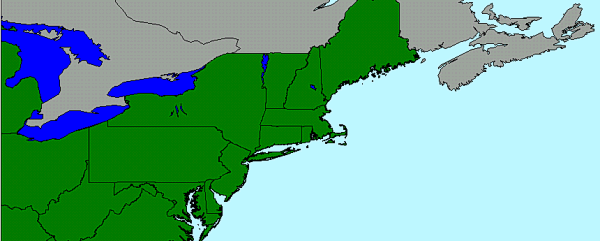
This ArcView shapefile represents the Canada and and it's individual provinces. The shapefile dataset is provided by Environmental Research Institution, Inc. (ESRI) as data distribution with their software.
Purpose:
This ArcView shapefile may be used as a general basemap data layer to illustrate the boundaries of Canada and it's coastline. boundaries and coastline.
Time_Period_of_Content:
Time_Period_Information:
Single_Date/Time:
Calendar_Date: 20010708
Currentness_Reference: Publication Date
Status:
Progress: Complete
Maintenance_and_Update_Frequency: None planned
Spatial_Domain:
Bounding_Coordinates:
West_Bounding_Coordinate: -84.1333
East_Bounding_Coordinate: -59.8097
North_Bounding_Coordinate: 47.2333
South_Bounding_Coordinate: 41.9133
Keywords:
Theme:
Theme_Keyword_Thesaurus: General
Theme_Keyword: U.S. Geological Survey
Theme_Keyword: Woods Hole Field Center
Theme_Keyword: Coastal and Marine Geology Program
Theme_Keyword: ArcView shapefile
Theme_Keyword: basemap
Place:
Place_Keyword_Thesaurus: General
Place_Keyword: Canada
Access_Constraints: None
Use_Constraints:
Although this derived data set and it's lineage dataset have been used by the USGS, no warranty, expressed or implied, is made by the USGS as to the accuracy of the data and/or related materials. The act of distribution shall not constitute any such warranty, and no responsibility is assumed by the USGS in the use of these data or related materials.
Point_of_Contact:
Contact_Information:
Contact_Organization_Primary:
Contact_Organization: U. S. Geological Survey
Contact_Person: Valerie Paskevich
Contact_Position: Computer Specialist
Contact_Address:
Address_Type: mailing and physical address
Address: 384 Woods Hole Road
City: Woods Hole
State_or_Province: MA
Postal_Code: 02532
Country: USA
Contact_Voice_Telephone: (508) 548-8700 x2281
Contact_Facsimile_Telephone: (508) 457-2310
Contact_Electronic_Mail_Address: vpaskevich@usgs.gov
Browse_Graphic:
Browse_Graphic_File_Name: canada.gif
Browse_Graphic_File_Description: image showing Canada shapefile
Browse_Graphic_File_Type: GIF
Data_Set_Credit: This dataset is compiled from the province shapefile.
Native_Data_Set_Environment: ArcView version 3.2

Data_Quality_Information:
Logical_Consistency_Report: none
Completeness_Report: This data set contains the complete Canada data layer for this project view
Lineage:
Source_Information:
Source_Citation:
Citation_Information:
Originator: Environmental Research Institution, Inc. (ESRI)
Publication_Date: 19990801
Publication_Time: Unknown
Title: ESRI Data & maps
Publication_Information:
Publication_Place: Redlands, CA
Publisher: Environmental Research Institution, Inc. (ESRI)
Type_of_Source_Media: CD-ROM
Source_Time_Period_of_Content:
Time_Period_Information:
Single_Date/Time:
Calendar_Date: 19990801
Source_Currentness_Reference: Publication Date
Source_Citation_Abbreviation: province.shp
Source_Contribution:
The province shapefile was copied from the ESRI distribution CD and renamed.
Process_Step:
Process_Description:
The complete province shapefile, as distributed by ESRI, was used to create the canada shapefile.
Source_Used_Citation_Abbreviation: province.dbf
Source_Used_Citation_Abbreviation: province.prj
Source_Used_Citation_Abbreviation: province.shp
Source_Used_Citation_Abbreviation: province.shx
Process_Date: 20010331
Source_Produced_Citation_Abbreviation: canada.avl
Source_Produced_Citation_Abbreviation: canada.dbf
Source_Produced_Citation_Abbreviation: canada.prj
Source_Produced_Citation_Abbreviation: canada.shp
Source_Produced_Citation_Abbreviation: canada.shx
Process_Contact:
Contact_Information:
Contact_Organization_Primary:
Contact_Organization: U. S. Geological Survey
Contact_Person: Valerie Paskevich
Contact_Position: Computer Specialist
Contact_Address:
Address_Type: mailing and physical address
Address: 384 Woods Hole Road
City: Woods Hole
State_or_Province: MA
Postal_Code: 02543
Country: USA
Contact_Voice_Telephone: (508) 548-8700 x2281
Contact_Facsimile_Telephone: (508) 457-2310
Contact_Electronic_Mail_Address: vpaskevich@usgs.gov
Process_Step:
Process_Description:
The Canada shapefile was clipped to the extent of the project view area.
Source_Used_Citation_Abbreviation: canada.dbf
Source_Used_Citation_Abbreviation: canada.shp
Process_Date: 20010608
Source_Produced_Citation_Abbreviation: canada.dbf
Source_Produced_Citation_Abbreviation: canada.shp
Process_Contact:
Contact_Information:
Contact_Organization_Primary:
Contact_Organization: U. S. Geological Survey
Contact_Person: Valerie Paskevich
Contact_Position: Computer Specialist
Contact_Address:
Address_Type: mailing and physical address
Address: 384 Woods Hole Road
City: Woods Hole
State_or_Province: MA
Postal_Code: 02543
Country: USA
Contact_Voice_Telephone: (508) 548-8700 x2281
Contact_Facsimile_Telephone: (508) 457-2310
Contact_Electronic_Mail_Address: vpaskevich@usgs.gov

Spatial_Data_Organization_Information:
Direct_Spatial_Reference_Method: Vector
Point_and_Vector_Object_Information:
SDTS_Terms_Description:
SDTS_Point_and_Vector_Object_Type: GT-polygon composed of chains
Point_and_Vector_Object_Count: 12

Spatial_Reference_Information:
Horizontal_Coordinate_System_Definition:
Geographic:
Latitude_Resolution: .2
Longitude_Resolution: .08
Geographic_Coordinate_Units: Decimal degrees
Geodetic_Model:
Horizontal_Datum_Name: North American Datum of 1927
Ellipsoid_Name: Clarke 1866
Semi-major_Axis: 6378206.4
Denominator_of_Flattening_Ratio: 294.9786982

Entity_and_Attribute_Information:
Detailed_Description:
Entity_Type:
Entity_Type_Label: canada.dbf
Entity_Type_Definition: Shapefile Attribute Table
Entity_Type_Definition_Source: None
Attribute:
Attribute_Label: Area
Attribute_Definition: Area of Polygon
Attribute_Definition_Source: Software computed
Attribute_Domain_Values:
Range_Domain:
Range_Domain_Minimum: 0.003
Range_Domain_Maximum: 20.225
Attribute:
Attribute_Label: Code
Attribute_Definition:
Assigned Province code 
CA04
CA07
CA08
CA09
CA10
Attribute_Definition_Source: User Defined
Attribute_Domain_Values:
Unrepresentable_Domain: Character field
Attribute:
Attribute_Label: Name
Attribute_Definition:
New Brunswick
Nova Scotia
Ontario
Prince Edward Island
Quebec
Attribute_Definition_Source: User Defined
Attribute_Domain_Values:
Unrepresentable_Domain: Character field
Attribute:
Attribute_Label: Pop_1991
Attribute_Definition: Province population from 1991
Attribute_Definition_Source: User Defined
Attribute_Domain_Values:
Range_Domain:
Range_Domain_Minimum: 129765
Range_Domain_Maximum: 10084885
Attribute_Measurement_Resolution: 1
Attribute:
Attribute_Label: Pop91_sqmi
Attribute_Definition: Average population per square mile of province from 1991
Attribute_Definition_Source: User Defined
Attribute_Domain_Values:
Range_Domain:
Range_Domain_Minimum: 13.163780
Range_Domain_Maximum: 59.389020

Distribution_Information:
Distributor:
Contact_Information:
Contact_Organization_Primary:
Contact_Organization: U. S. Geological Survey
Contact_Person: Valerie Paskevich
Contact_Position: Computer Specialist
Contact_Address:
Address_Type: mailing and physical address
Address: 384 Woods Hole Road
City: Woods Hole
State_or_Province: MA
Postal_Code: 02543
Country: USA
Contact_Voice_Telephone: (508) 548-8700 x2281
Contact_Facsimile_Telephone: (508) 457-2310
Contact_Electronic_Mail_Address: vpaskevich@usgs.gov
Resource_Description: Canada shapefile
Distribution_Liability:
Although this derived data set and it's lineage dataset have been used by the USGS, no warranty, expressed or implied, is made by the USGS as to the accuracy of the data and/or related materials. The act of distribution shall not constitute any such warranty, and no responsibility is assumed by the USGS in the use of these data or related materials.
Standard_Order_Process:
Digital_Form:
Digital_Transfer_Information:
Format_Name: ARCV
Format_Information_Content:
canada.avl 
canada.dbf 
canada.prj 
canada.sbn 
canada.sbx 
canada.shp 
canada.shx
File_Decompression_Technique: No compression applied
Transfer_Size: 285,704Kb
Digital_Transfer_Option:
Offline_Option:
Offline_Media: CD-ROM
Recording_Capacity:
Recording_Density: 650
Recording_Density_Units: Mbytes
Recording_Format: ISO 9600
Compatibility_Information:
The user must have a system with a CD-ROM capable of reading an ISO-9660 standard CD-ROM disk. To browse the information contained on this disk, the user must also have a current version of WWW browser available.
Digital_Form:
Digital_Transfer_Information:
Format_Name: ARCV
Format_Information_Content: The seven files comprising the Canada land mass
File_Decompression_Technique: zip
Transfer_Size: 123Kb
Digital_Transfer_Option:
Offline_Option:
Offline_Media: CD-ROM
Recording_Capacity:
Recording_Density: 650
Recording_Density_Units: Mbytes
Recording_Format: ISO 9600
Compatibility_Information:
The user must have a system with a CD-ROM capable of reading an ISO-9660 standard CD-ROM disk. To browse the information contained on this disk, the user must also have a current version of WWW browser available.
Fees: none
Technical_Prerequisites:
The base map overlay is available as an ArcView shapefile format. The user must have ESRI's ArcView 3.0 or greater software to read and process the data file. In lieu of Arcview, the user may utilize another GIS application package capable of importing the data.
 
Access to the data and information contained on this CD-ROM was developed using the HyperText Markup Language (HTML) utilized by the World Wide Web (WWW) project. Development of the CD-ROM documentation and user interface in HTML allows a user to access the information by using a variety of WWW information browsers to facilitate browsing and locating information and data. To access the information contained on this disk with a WWW client browser, open the file 'index.htm' at the top level directory of this CD-ROM with your selected browser. This CD-ROM should be readable by a variety of operating systems including Windows 95/98/NT, Macintosh and UNIX.

Metadata_Reference_Information:
Metadata_Date: 20010708
Metadata_Contact:
Contact_Information:
Contact_Organization_Primary:
Contact_Organization: U. S. Geological Survey
Contact_Person: Valerie Paskevich
Contact_Position: Computer Specialist
Contact_Address:
Address_Type: mailing and physical address
Address: 384 Woods Hole Rd.
City: Woods Hole
State_or_Province: MA
Postal_Code: 02543
Country: USA
Contact_Voice_Telephone: (508) 548-8700 x2281
Contact_Facsimile_Telephone: (508) 457-2310
Contact_Electronic_Mail_Address: vpaskevich@usgs.gov
Metadata_Standard_Name: FGDC Content Standards for Digital Geospatial Metadata
Metadata_Standard_Version: FGDC-STD-001-1998
Metadata_Time_Convention: Local time
Metadata_Access_Constraints: None
Metadata_Use_Constraints: None

Generated by mp version 2.5.3 on Sun Jul 08 18:50:09 2001