

A Comparative Analysis of Hazard Models for Predicting
Debris Flows in Madison County, Virginia
By
Meghan M. Morrissey, Gerald F. Wieczorek, and Benjamin
A. Morgan
Open-File Report 01-0067
2001
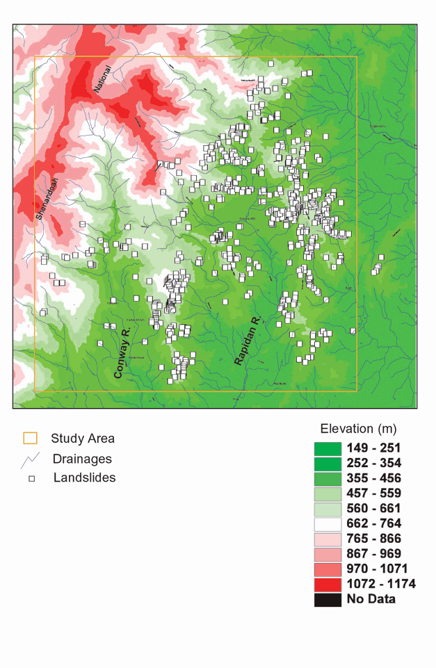
Figure 3. Topographic map of the study area that includes the locations of inventoried landslides (small squares) triggered by the June 27, 1995 rainstorm.