|
|
|
||||
| Open-File Report 01–104: Disk Organization and Data Directory |
 |
|
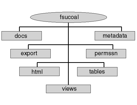
Data Directory - fsucoal
|
Back to Data Directory |
|
(Documentation in hypertext format)
|
Back to Data Directory |
|
(Permission to distribute proprietary data)
|
Back to Data Directory |
|
|
| basins.csv | Coal basins of the Former Soviet Union; attribute data in comma delimited text format. |
| basins.gen | Coal basins of the Former Soviet Union; polygon topology data in Arc/Info ungenerate format. |
| coal_dep.csv | Coal deposit data. This shape file is linked in the ArcView project with coal mark data from the Survey Map of Coal Basins and Deposits of the U.S.S.R. by Tyzhnov and Molchanov (1976); attribute data in comma delimited text format. |
| coal_dep.gen | Coal deposit data. This shape file is linked in the ArcView project with coal mark data from the Survey Map of Coal Basins and Deposits of the U.S.S.R. by Tyzhnov and Molchanov (1976); point topology data in Arc/Info ungenerate format. |
| coal_pt.csv | Coal data points linked in ArcView project with coal quality data from Vernadsky State Geological Museum (general.dbf, std_char.dbf, elemcomp.dbf, mineral.dbf); attribute data in comma delimited text format. |
| coal_pt.gen | Coal data points linked in ArcView project with coal quality data from Vernadsky State Geological Museum (general.dbf, std_char.dbf, elemcomp.dbf, mineral.dbf); point topology data in Arc/Info ungenerate format. |
| deposit.csv | Coal deposits of the Former Soviet Union; attribute data in comma delimited text format. |
| deposit.gen | Coal deposits of the Former Soviet Union; polygon topology data in Arc/Info ungenerate format. |
| fsu_geol.csv | Surface geology of the Former Soviet Union; attribute data in comma delimited text format. |
| fsu_geo.gen | Surface geology of the Former Soviet Union; polygon topology data in Arc/Info ungenerate format. |
| terr.csv | Coal-bearing basins and areas of the Former Soviet Union; attribute data in comma delimited text format. |
| terr.gen | Coal-bearing basins and areas of the Former Soviet Union; polygon topology in Arc/Info ungenerate format. |
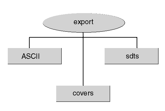
Data Directory - covers
(Spatial data in Arc/Info export format)
| basins.e00 | Coal basins of the Former Soviet Union; Arc/Info export format. |
| coal_dep.e00 | Coal deposit data. This shape file is linked in the ArcView project with coal mark data from the Survey Map of Coal Basins and Deposits of the U.S.S.R. by Tyzhnov and Molchanov (1976); Arc/Info export format. |
| coal_pt.e00 | Coal data points linked in ArcView project with coal quality data from Vernadsky State Geological Museum (general.dbf, std_char.dbf, elemcomp.dbf, mineral.dbf); Arc/Info export format. |
| deposit.e00 | Coal deposits of the Former Soviet Union; Arc/Info export format. |
| fsu_geol.e00 | Surface geology of the Former Soviet Union; Arc/Info export format. |
| terr.e00 | Coal-bearing basins and areas of the Former Soviet Union; Arc/Info export format. |
| basn | Coal basins of the Former Soviet Union; SDTS format directory |
| depo | Coal deposits of the Former Soviet Union; SDTS format directory |
| terr | Coal-bearing basins and areas of the Former Soviet Union; SDTS format directory |
| geol | Surface geology of the Former Soviet Union; SDTS format directory |
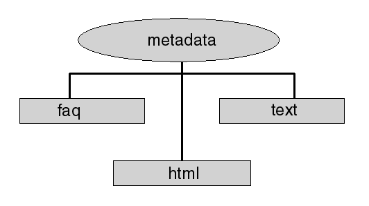
Data Directory - faq
(metadata in FAQ (Frequently Anticipated Questions) format)
| basins.htm | Coal basins of the Former Soviet Union; FAQ format metadata document |
| capitols.htm | Capitol cities of the countries comprising the Former Soviet Union; FAQ format metadata document |
| cis.htm | Political boundaries of the countries comprising the Former Soviet Union; FAQ format metadata document |
| cities.htm | Selected cities of the Former Soviet Union; FAQ format metadata document |
| coal_dep.htm | Coal deposit data. This shape file is linked in the ArcView project with coal mark data from the Survey Map of Coal Basins and Deposits of the U.S.S.R. by Tyzhnov and Molchanov (1976); FAQ format metadata document |
| coal_pt.htm | Coal data points linked in ArcView project with coal quality data from Vernadsky State Geological Museum (general.dbf, std_char.dbf, elemcomp.dbf, mineral.dbf); FAQ format metadata document |
| coalbnd.htm | Boundaries of coal-bearing territories and basins of the Former Soviet Union; FAQ format metadata document |
| deposit.htm | Coal deposits of the Former Soviet Union; FAQ format metadata document |
| fsu_geol.htm | Surface geology of the Former Soviet Union; FAQ format metadata document |
| lakes.htm | Lakes and surface water bodies of the Former Soviet Union; FAQ format metadata document |
| rails.htm | Railroads of the Former Soviet Union; FAQ format metadata document |
| rivers.htm | Rivers of the Former Soviet Unon; FAQ format metadata document |
| roads.htm | Roads of the Former Soviet Union; FAQ format metadata document |
| terr.htm | Coal-bearing basins and areas of the Former Soviet Union; FAQ format metadata document |
| basins.htm | Coal basins of the Former Soviet Union; html format metadata document |
| capitols.htm | Capitol cities of the countries comprising the Former Soviet Union; html format metadata document |
| cis.htm | Political boundaries of the countries comprising the Former Soviet Union; html format metadata document |
| cities.htm | Selected cities of the Former Soviet Union; html format metadata document |
| coal_dep.htm | Coal deposit data. This shape file is linked in the ArcView project with coal mark data from the Survey Map of Coal Basins and Deposits of the U.S.S.R. by Tyzhnov and Molchanov (1976); html format metadata document |
| coal_pt.htm | Coal data points linked in ArcView project with coal quality data from Vernadsky State Geological Museum (general.dbf, std_char.dbf, elemcomp.dbf, mineral.dbf); html format metadata document |
| coalbnd.htm | Boundaries of coal-bearing territories and basins of the Former Soviet Union; html format metadata document |
| deposit.htm | Coal deposits of the Former Soviet Union; html format metadata document |
| fsu_geol.htm | Surface geology of the Former Soviet Union; html format metadata document |
| lakes.htm | Lakes and surface water bodies of the Former Soviet Union; html format metadata document |
| rails.htm | Railroads of the Former Soviet Union; html format metadata document |
| rivers.htm | Rivers of the Former Soviet Unon; html format metadata document |
| roads.htm | Roads of the Former Soviet Union; html format metadata document |
| terr.htm | Coal-bearing basins and areas of the Former Soviet Union; html format metadata document |
| basins.txt | Coal basins of the Former Soviet Union; DOS text format metadata document |
| capitols.txt | Capitol cities of the countries comprising the Former Soviet Union; DOS text format metadata document |
| cis.txt | Political boundaries of the countries comprising the Former Soviet Union; DOS text format metadata document |
| cities.txt | Selected cities of the Former Soviet Union; DOS text format metadata document |
| coal_dep.txt | Coal deposit data. This shape file is linked in the ArcView project with coal mark data from the Survey Map of Coal Basins and Deposits of the U.S.S.R. by Tyzhnov and Molchanov (1976); DOS text format metadata document |
| coal_pt.txt | Coal data points linked in ArcView project with coal quality data from Vernadsky State Geological Museum (general.dbf, std_char.dbf, elemcomp.dbf, mineral.dbf); DOS text format metadata document |
| coalbnd.txt | Boundaries of coal-bearing territories and basins of the Former Soviet Union; DOS text format metadata document |
| deposit.txt | Coal deposits of the Former Soviet Union; DOS text format metadata document |
| fsu_geol.txt | Surface geology of the Former Soviet Union; DOS text format metadata document |
| lakes.txt | Lakes and surface water bodies of the Former Soviet Union; DOS text format metadata document |
| rails.txt | Railroads of the Former Soviet Union; DOS text format metadata document |
| rivers.txt | Rivers of the Former Soviet Union; DOS text format metadata document |
| roads.txt | Roads of the Former Soviet Union; DOS text format metadata document |
| terr.txt | Coal-bearing basins and areas of the Former Soviet Union; DOS text format metadata document |
Data Directory - csv
(Tabular data in comma delimited text format)
| coal1.csv | Table of coal-bearing area and territory names and ages of the Former Soviet Union, joined in the ArcView project with terr.shp; comma delimited text format |
| dep.csv | Table of coal deposit names and ages of the Former Soviet Union, joined in the ArcView project with deposit.shp; comma delimited text format |
| elemcomp.csv | Table of major-, minor- and trace element contents in coal of the Former Soviet Union, joined in the ArcView project with coal_pt.shp; key field: coal_key; compiled by USGS from data supplied by Vernadsky State Geological Museum; comma delimited text format |
| general.csv | Table of general characteristics of coal data points in the Former Soviet Union, joined in the ArcView project with coal_pt.shp; key field: coal_key; compiled by USGS from data supplied by Vernadsky State Geological Museum; comma delimited text format |
| mark.csv | Table of coal marks; comma delimited text format |
| mineral.csv | Table of mineral composition of coal (in volume percent) and size distribution (in mm) of coal, fraction yield and ash content in percent of coal data points in the Former Soviet Union, joined in the ArcView project with coal_pt.shp; key field: coal_key; compiled by USGS from data supplied by Vernadsky State Geological Museum; comma delimited text format |
| std_char.csv | Standard characteristics of coal data points in the Former Soviet Union, compiled by USGS from data supplied by Vernadsky State Geological Museum; comma delimited text format |
| washdata.csv | Washability data of coal in the Former Soviet Union, compiled by USGS from data supplied by Vernadsky State Geological Museum; comma delimited text format |
Data Directory - dbf
(Tabular data in dbase IV format)
| coal1.dbf | Table of coal-bearing area and territory names and ages of the Former Soviet Union, joined in the ArcView project with terr.shp; Dbase IV format |
| dep.dbf | Table of coal deposit names and ages of the Former Soviet Union, joined in the ArcView project with deposit.shp; Dbase IV format |
| elemcomp.dbf | Table of major-, minor- and trace element contents in coal of the Former Soviet Union, joined in the ArcView project with coal_pt.shp; key field: coal_key; compiled by USGS from data supplied by Vernadsky State Geological Museum; Dbase IV format |
| general.dbf | Table of general characteristics of coal data points in the Former Soviet Union, joined in the ArcView project with coal_pt.shp; key field: coal_key; compiled by USGS from data supplied by Vernadsky State Geological Museum; Dbase IV format |
| mark.dbf | Table of coal marks; Dbase IV format |
| mineral.dbf | Table of mineral composition of coal (in volume percent) and size distribution (in mm) of coal, fraction yield and ash content in percent of coal data points in the Former Soviet Union, joined in the ArcView project with coal_pt.shp; key field: coal_key; compiled by USGS from data supplied by Vernadsky State Geological Museum; Dbase IV format |
| std_char.dbf | Standard characteristics of coal data points in the Former Soviet Union, compiled by USGS from data supplied by Vernadsky State Geological Museum; Dbase IV format |
| washdata.dbf | Washability data of coal in the Former Soviet Union, compiled by USGS from data supplied by Vernadsky State Geological Museum; Dbase IV format |
| coal1.xls | Table of coal-bearing area and territory names and ages of the Former Soviet Union, joined in the ArcView project with terr.shp; MS Excel v6.0 format |
| dep.xls | Table of coal deposit names and ages of the Former Soviet Union, joined in the ArcView project with deposit.shp; MS Excel v6.0 format |
| elemcomp.xls | Table of major-, minor- and trace element contents in coal of the Former Soviet Union, joined in the ArcView project with coal_pt.shp; key field: coal_key; compiled by USGS from data supplied by Vernadsky State Geological Museum; MS Excel v6.0 format |
| general.xls | Table of general characteristics of coal data points in the Former Soviet Union, joined in the ArcView project with coal_pt.shp; key field: coal_key; compiled by USGS from data supplied by Vernadsky State Geological Museum; MS Excel v6.0 format |
| mark.xls | Table of coal marks; MS Excel v6.0 format |
| mineral.xls | Table of mineral composition of coal (in volume percent) and size distribution (in mm) of coal, fraction yield and ash content in percent of coal data points in the Former Soviet Union, joined in the ArcView project with coal_pt.shp; key field: coal_key; compiled by USGS from data supplied by Vernadsky State Geological Museum; MS Excel v6.0 format |
| std_char.xls | Standard characteristics of coal data points in the Former Soviet Union, compiled by USGS from data supplied by Vernadsky State Geological Museum; MS Excel v6.0 format |
| washdata.xls | Washability data of coal in the Former Soviet Union, compiled by USGS from data supplied by Vernadsky State Geological Museum; MS Excel v6.0 format |
| dongeo.tif | Donetsky basin geology, ungeoreferenced map image |
| donlegend.tif | Donetsky basin geological legend image |
| donresleg.tif | Donetsky basin coal resources legend image |
| donresor.tif | Donetsky basin coal resources, ungeoreferenced map image |
| ekgeo.tif | Ekibastuz geology, ungeoreferenced map image |
| ekleg.tif | Ekibastuz geological legend image |
| fangeo.tif | Fan-Yagnob geology, unreferenced map image |
| fanleg.tif | Fan-Yagnob geological legend image |
| kuzgeol.tif | Kuznetsky basin geology, ungeorefenced map image |
| kuzlegend.tif | Kuznetsky basin geological legend image |
| kuzres.tif | Kuznetsky basin coal resources, ungeoreferenced map image |
| kuzresleg.tif | Kuznetsky basin coal resources legend image |
| tkvgeol1.tif | Tkvarchel'skoye geology, unreferenced map image |
| tkvlegend.tif | Tkvarchel'skoye geological legend image |
| basin.avl | Legend file for drawing basin.shp |
| basinbdry.avl | Legend file for drawing boundary.shp |
| cis.avl | Legend file for drawing cis.shp |
| coalrank.avl | Legend file for drawing coal_dep.shp |
| ek1geo.avl | Legend file for geologic age colors for Ekibastuz cross-section A |
| ek2geo.avl | Legend file for geologic age colors for Ekibastuz cross-section B |
| fan1xgeo.avl | Legend file for geologic age colors for Fan-Yagnob cross-sections A and B |
| geol.avl | Legend for for geologic age colors for fsu_geol.shp (Surface geology of Former Soviet Union) |
| roads.avl | Legend for drawing roads.shp |
Data Directory - scripts
(Avenue scripts)
| dongeo.ave | Script drawing Donetsky basin geology view |
| dongeolg.ave | Script drawing Donetsky basin geology legend |
| donres.ave | Script drawing Donetsky basin coal resources view |
| donresle.ave | Script drawing Donetsky basin coal resources legend |
| eki1.ave | Script drawing Ekibastuz cross-section A |
| eki2.ave | Script drawing Ekibastuz cross-section B |
| ekigeo.ave | Script drawing Ekibastuz geology view |
| ekigeolg.ave | Script drawing Ekibastuz geology legend |
| fan1.ave | Script drawing Fan-Yagnob cross-section A |
| fan2.ave | Script drawing Fan-Yagnob cross-section B |
| fangeo.ave | Script drawing Fan-Yagnob geology view |
| fangeolg.ave | Script drawing Fan-Yagnob geology legend |
| Fsu.ave | Script drawing Coal Resources of the Former Soviet Union view |
| Geol.ave | Script drawing Surface Geology of the Former Soviet Union view |
| Hotlink.ave | Script configuring hotlink tool |
| hotlinku.ave | Script updating hotlink tool |
| kuzgeol.ave | Script drawing Kuznetsky basin geology view |
| kuzgeole.ave | Script drawing Kuznetsky basin geology legend |
| kuzresleg.ave | Script drawing Kuznetsky basin coal resources legend |
| kuzres.ave | Script drawing Kuznetsky basin coal resources view |
| Startup.ave | Startup script for ArcView project |
| territor.ave | Script drawing Coal Basins and Territories of the Former Soviet Union view |
| tkvres.ave | Script drawing Tkvarchel'skoye coal resources view |
| tkvreslg.ave | Script drawing Tkvarchel'skoye coal resources legend |
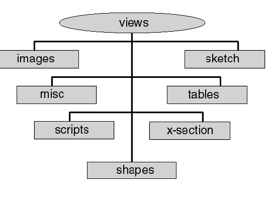
Data Directory - shapes
(Spatial data in ArcView shapefile format)
Each shapefile consists of three files: *.shp - topology, *.dbf - attributes, *.shx - spatial index
Only the *.shp file is listed here
| basins.shp | Coal basins of the Former Soviet Union |
| capitols.shp | Capitol cities of the countries comprising the Former Soviet Union |
| cis.shp | generalized political boundaries of the countries comprising the Former Soviet Union |
| cities.shp | Selected cities of the Former Soviet Union |
| coal_dep.shp | Coal deposit data. This shape file is linked in the ArcView project with coal mark data from the Survey Map of Coal Basins and Deposits of the U.S.S.R. by Tyzhnov and Molchanov (1976) |
| coal_pt.shp | Coal data points linked in ArcView project with coal quality data from Vernadsky State Geological Museum (general.dbf, std_char.dbf, elemcomp.dbf, mineral.dbf) |
| coalbnd.shp | Boundaries of coal-bearing territories and basins of the Former Soviet Union |
| deposit.shp | Coal deposits of the Former Soviet Union |
| fsu_geol.shp | Surface geology of the Former Soviet Union |
| lakes.shp | Lakes and surface water bodies of the Former Soviet Union |
| rail.shp | Railroads of the Former Soviet Union |
| rivers.shp | Rivers of the Former Soviet Union |
| roads.shp | Roads of the Former Soviet Union |
| terr.shp | Coal-bearing basins and areas of the Former Soviet Union |
Data Directory - sketch
(ArcView shapefiles of ungeoreferenced data)
Each shapefile consists of three files: *.shp - topology, *.dbf - attributes, *.shx - spatial index
Only the *.shp file is listed here
| eki_line.shp | Cross-section line on Ekibastuz geology view |
| fan_line.shp | Cross-section line on Fan-Yagnob geology view |
| pit_kuz.shp | Open-pit coal mines in the Kuznetsky basin |
| point_don.shp | Coal data points in the Donetsky basin |
| point_kuz.shp | Coal data poins in the Kuznetsky basin |
Data Directory - tables
(Dbase IV format data tables used in ArcView project)
| coal1.dbf | Table of coal-bearing area and territory names and ages of the Former Soviet Union, joined in the ArcView project with terr.shp; Dbase IV format |
| dep.dbf | Table of coal deposit names and ages of the Former Soviet Union, joined in the ArcView project with deposit.shp; Dbase IV format |
| elemcomp.dbf | Table of major-, minor- and trace element contents in coal of the Former Soviet Union, joined in the ArcView project with coal_pt.shp; key field: coal_key; compiled by USGS from data supplied by Vernadsky State Geological Museum; Dbase IV format |
| general.dbf | Table of general characteristics of coal data points in the Former Soviet Union, joined in the ArcView project with coal_pt.shp; key field: coal_key; compiled by USGS from data supplied by Vernadsky State Geological Museum; Dbase IV format |
| mark.dbf | Table of coal marks; Dbase IV format |
| mineral.dbf | Table of mineral composition of coal (in volume percent) and size distribution (in mm) of coal, fraction yield and ash content in percent of coal data points in the Former Soviet Union, joined in the ArcView project with coal_pt.shp; key field: coal_key; compiled by USGS from data supplied by Vernadsky State Geological Museum; Dbase IV format |
| std_char.dbf | Standard characteristics of coal data points in the Former Soviet Union, compiled by USGS from data supplied by Vernadsky State Geological Museum; Dbase IV format |
| terr.dbf | Table of coal territory names and ages of the Former Soviet Union, joined in the ArcView project with deposit.shp; Dbase IV format |
| washdata.dbf | Washability data of coal in the Former Soviet Union, compiled by USGS from data supplied by Vernadsky State Geological Museum; Dbase IV format |
Data Directory - x-section
(ArcView shapefiles used in cross-sections)
Each shapefile consists of three files: *.shp - topology, *.dbf - attributes, *.shx - spatial index
Only the *.shp file is listed here
(Ungeoreferenced)
| ek1bnd.shp | Boundary for Ekibastuz cross-section A |
| ek1coal.shp | Coal-bearing units for Ekibastuz cross-section A |
| ek1geo.shp | Geologic age of units for Ekibastuz cross-section A |
| ek1otcp.shp | Outcrop for Ekibastuz cross-section A |
| eki12_bnd.shp | Boundary for Ekibastuz cross-section B |
| eki2coal.shp | Coal-bearing units for Ekibastuz cross-section B |
| eki2geo.shp | Geologic age of units for Ekibastuz cross-section B |
| eki2otcp.shp | Outcrop for Ekibastuz cross-section B |
| fan1bnd.shp | Boundary for Fan-Yagnob cross-section A |
| fan1bore.shp | Borehole for Fan-Yagnob cross-section A |
| fan1geo.shp | Geologic age of units for Fan-Yagnob cross-section A |
| fan2bnd.shp | Boundary for Fan-Yagnob cross-section B |
| fan2bore.shp | Borehole for Fan-Yagnob cross-section B |
| fan2geo.shp | Geologic age of units for Fan-Yagnob cross-section B |
| AccessibilityFOIAPrivacyPolicies and Notices | |
 |
|