![]()
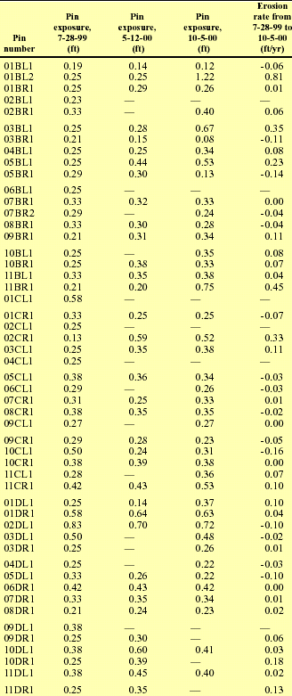
| Table 2. Erosion pin measurements and erosion rates between 1999 and 2000, South Fork Campbell Creek near Anchorage, Alaska |
| [Pin number: Pins are designated by transect (first three digits); by side of channel (L, left; R, right); and by position on bank (2, lowermost pin where more than one pin is present). Rate for 09DR1, 10DR1, and 11DR1 is from 7-28-99 to 5-12-00 because pin was not found on 10-5-00. Negative values indicate deposition. —, pin not found. Note that many pins were under winter ice on 5-12-00. ft, foot; ft/yr, foot per year] |
 |