PANTANO WASH NEAR VAIL (09484600) |
|
GILA RIVER AT CALVA (09466500)
|
GILA RIVER AT KELVIN (09474000)
|
GILA RIVER BELOW BLUE CREEK (09432000)
|
SANTA CRUZ RIVER AT TUCSON (09482500)
|
SAN PEDRO RIVER AT CHARLESTON (09471000)
|
|
||||||||||
SANTA CRUZ RIVER NEAR LOCHIEL (09480000)
|
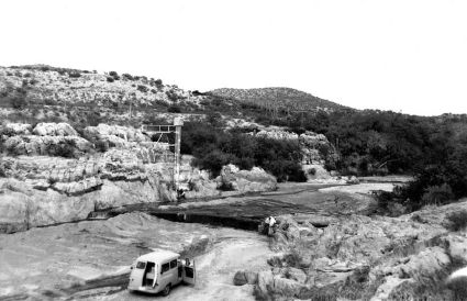
(June 1968). The gaging station at Lochiel measures flow in the Santa Cruz River before it enters Mexico. The river winds through the broad San Rafael Valley, a grassland, and the shallow channel had scattered cottonwood trees along it in 1968. This upstream view shows the gaging station and the low-water control (R.L.T., no number).
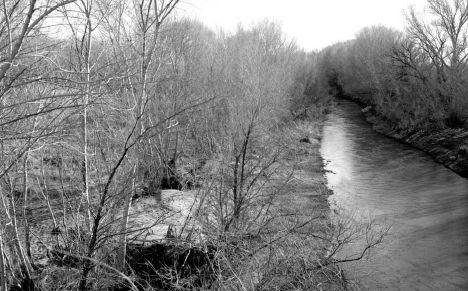
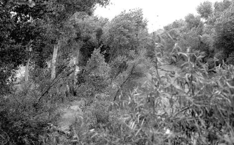
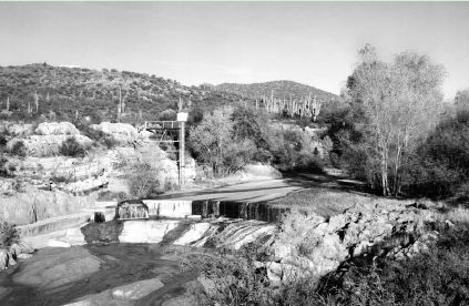
(October 8, 2000). The channel has meandered to the left despite a grade-control structure just downstream from the bridge. Cottonwoods have grown up throughout the view, and no woody non-native riparian species are present. The bed sediment in the reach has coarsened, increasing channel roughness (Dominic Oldershaw, Stake 1953).
Download the PDF version of the report for high-resolution, printable pages (1MB).
Document Accessibility: Adobe Systems Incorporated has information about PDFs and the visually impaired. This information provides tools to help make PDF files accessible. These tools convert Adobe PDF documents into HTML or ASCII text, which then can be read by a number of common screen-reading programs that synthesize text as audible speech. In addition, an accessible version of Acrobat Reader 5.0 for Windows (English only), which contains support for screen readers, is available. These tools and the accessible reader may be obtained free from Adobe at Adobe Access.
 (March
6, 1932). The Gila River was ravaged by floods in the 1910s and 1920s,
including one flood estimated at 100,000 ft³/s in 1916. This upstream
view from the railroad bridge at Calva shows a wide, braided channel.
An open cottonwood gallery forest appears in the midground at left (channel
right), and the low shrubs at right appear to be native willows (W.E.
Dickinson, #1053).
(March
6, 1932). The Gila River was ravaged by floods in the 1910s and 1920s,
including one flood estimated at 100,000 ft³/s in 1916. This upstream
view from the railroad bridge at Calva shows a wide, braided channel.
An open cottonwood gallery forest appears in the midground at left (channel
right), and the low shrubs at right appear to be native willows (W.E.
Dickinson, #1053).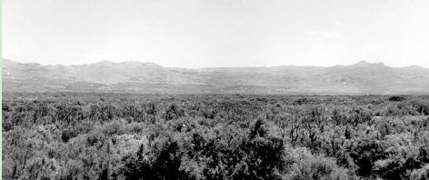 (June
18, 1964). In the intervening 32 years, the highest discharge through
this reach was 27,900 ft³/s on October 1, 1941. Dense tamarisk has become
established, creating a floodplain where the main channel once was. The
channel has shifted to the right and is much smaller than it was in 1932
(Raymond M. Turner).
(June
18, 1964). In the intervening 32 years, the highest discharge through
this reach was 27,900 ft³/s on October 1, 1941. Dense tamarisk has become
established, creating a floodplain where the main channel once was. The
channel has shifted to the right and is much smaller than it was in 1932
(Raymond M. Turner).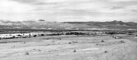 (October
17, 1973). To reduce evapotranspiration, phreatophytes (mostly tamarisk)
were removed from this reach in 1970, and the floodplain was reseeded
to native grasses. Those grasses are mostly gone at the time of this photograph,
one year after a flood of 80,000 ft³/s passed through this reach. The
small shrubs throughout the view are mostly tamarisks that are re-establishing
in the reach (Raymond M. Turner).
(October
17, 1973). To reduce evapotranspiration, phreatophytes (mostly tamarisk)
were removed from this reach in 1970, and the floodplain was reseeded
to native grasses. Those grasses are mostly gone at the time of this photograph,
one year after a flood of 80,000 ft³/s passed through this reach. The
small shrubs throughout the view are mostly tamarisks that are re-establishing
in the reach (Raymond M. Turner).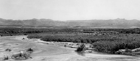 (May
21, 1984). In October 1983, a flood of 150,000 ft³/s passed through this
reach in the wake of Tropical Storm Octave. This flood followed one that
peaked at 100,000 ft³/s in 1978. These floods shifted the channel back
into the view, and driftwood racks appear throughout the foreground. Despite
this flood, dense tamarisk appears on both floodplains (Raymond M. Turner).
(May
21, 1984). In October 1983, a flood of 150,000 ft³/s passed through this
reach in the wake of Tropical Storm Octave. This flood followed one that
peaked at 100,000 ft³/s in 1978. These floods shifted the channel back
into the view, and driftwood racks appear throughout the foreground. Despite
this flood, dense tamarisk appears on both floodplains (Raymond M. Turner).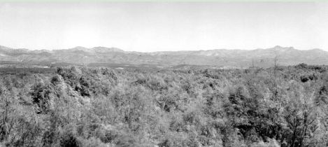 (October
6, 2000). Except for withdrawals of domestic and irrigation water at low-head
diversion dams, the Gila River is unregulated upstream from Calva. In
January and February, 1993, three floods passed through this reach that
exceeded 100,000 ft³/s. Despite these floods, tamarisk has grown considerably,
blocking the view of the river channel from this camera station. Despite
the enormous effort at tamarisk removal and river restoration, the tamarisk
has attained a higher biomass than it had in 1964. The channel has shifted
from the right side to the left side of this view (Dominic Oldershaw,
Stake 331a).
(October
6, 2000). Except for withdrawals of domestic and irrigation water at low-head
diversion dams, the Gila River is unregulated upstream from Calva. In
January and February, 1993, three floods passed through this reach that
exceeded 100,000 ft³/s. Despite these floods, tamarisk has grown considerably,
blocking the view of the river channel from this camera station. Despite
the enormous effort at tamarisk removal and river restoration, the tamarisk
has attained a higher biomass than it had in 1964. The channel has shifted
from the right side to the left side of this view (Dominic Oldershaw,
Stake 331a).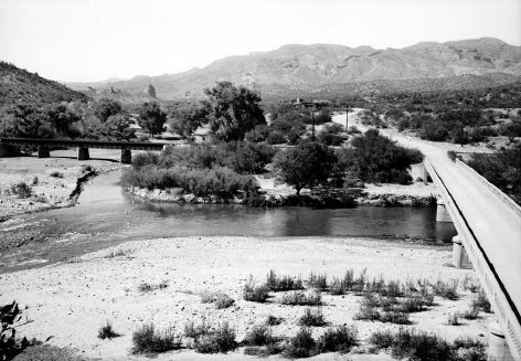 (May
21, 1945). This view, from a hill on the south side of the Gila River,
shows the bridge at Kelvin from which discharge measurements are made
at high flows. The river flows from right to left in this view and is
regulated by Coolidge Dam, completed in 1928. The largest historic flood
at this station is 132,000 ft³/s in 1916, and three other annual flood
peaks exceeded 40,000 ft³/s before 1945. Floods were less than 40,000
ft³/s for 15 years prior to this photograph. Tamarisk is becoming established
in the foreground, and mesquite and cottonwood trees appear on the far
bank. Mineral Creek, spanned by a railroad bridge, enters the Gila River
at left (W.L. Heckler, #3709).
(May
21, 1945). This view, from a hill on the south side of the Gila River,
shows the bridge at Kelvin from which discharge measurements are made
at high flows. The river flows from right to left in this view and is
regulated by Coolidge Dam, completed in 1928. The largest historic flood
at this station is 132,000 ft³/s in 1916, and three other annual flood
peaks exceeded 40,000 ft³/s before 1945. Floods were less than 40,000
ft³/s for 15 years prior to this photograph. Tamarisk is becoming established
in the foreground, and mesquite and cottonwood trees appear on the far
bank. Mineral Creek, spanned by a railroad bridge, enters the Gila River
at left (W.L. Heckler, #3709).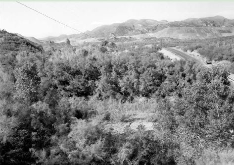 (October
2, 2000). The view is blocked by cottonwood trees, particularly at left
and right with small trees in the foreground, and large tamarisk trees.
This increase in riparian vegetation has occurred despite the fact that
floods of 100,000 and 74,900 ft³/s, in 1983 and 1993 respectively, passed
through this reach (Dominic Oldershaw, Stake 430).
(October
2, 2000). The view is blocked by cottonwood trees, particularly at left
and right with small trees in the foreground, and large tamarisk trees.
This increase in riparian vegetation has occurred despite the fact that
floods of 100,000 and 74,900 ft³/s, in 1983 and 1993 respectively, passed
through this reach (Dominic Oldershaw, Stake 430). (July
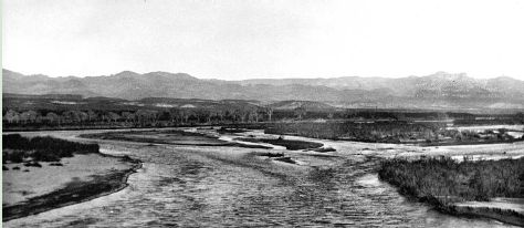
23, 1931). The Gila River upstream from its juncture with Blue Creek
near the Arizona-New Mexico border drains 3,203 mi2 of rangeland
and the Gila Wilderness. Just downstream from Blue Creek, the channel
is somewhat confined within a bedrock canyon, but just upstream,
as this view shows, the valley is relatively wide (James Baumgartner,
#1501).
(July
23, 1931). The Gila River upstream from its juncture with Blue Creek
near the Arizona-New Mexico border drains 3,203 mi2 of rangeland
and the Gila Wilderness. Just downstream from Blue Creek, the channel
is somewhat confined within a bedrock canyon, but just upstream,
as this view shows, the valley is relatively wide (James Baumgartner,
#1501). 
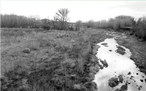
 (October
5, 2000). The channel has shifted to the left, possibly during one
of the four floods that exceeded 27,000 ft³/s between 1964 and 2000.
The cottonwood gallery has been destroyed, and the channel is lined
with tamarisk and coyote willows with scattered brickellbush (Dominic
Oldershaw, Stake 346a).
(October
5, 2000). The channel has shifted to the left, possibly during one
of the four floods that exceeded 27,000 ft³/s between 1964 and 2000.
The cottonwood gallery has been destroyed, and the channel is lined
with tamarisk and coyote willows with scattered brickellbush (Dominic
Oldershaw, Stake 346a).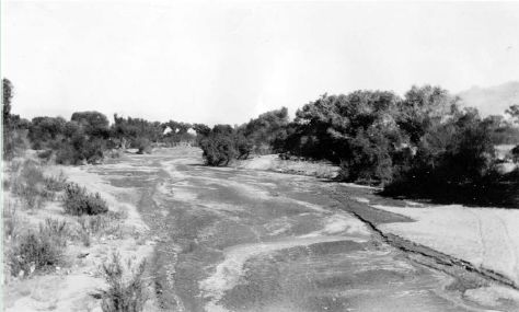 (November
22, 1930). This downstream view, taken from near the west abutment of
the old Congress Street Bridge, shows the wide alluvial channel of the
Santa Cruz River. At this time, the river flowed through a rural area,
and cottonwood trees lined its banks. The relatively shallow arroyo began
downcutting in 1878, and the 1914 flood of 15,000 ft³/s and 1917 flood
of 7,500 ft³/s caused the most recent channel change before 1930 (photographer
and number unknown).
(November
22, 1930). This downstream view, taken from near the west abutment of
the old Congress Street Bridge, shows the wide alluvial channel of the
Santa Cruz River. At this time, the river flowed through a rural area,
and cottonwood trees lined its banks. The relatively shallow arroyo began
downcutting in 1878, and the 1914 flood of 15,000 ft³/s and 1917 flood
of 7,500 ft³/s caused the most recent channel change before 1930 (photographer
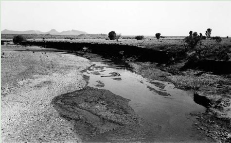
and number unknown).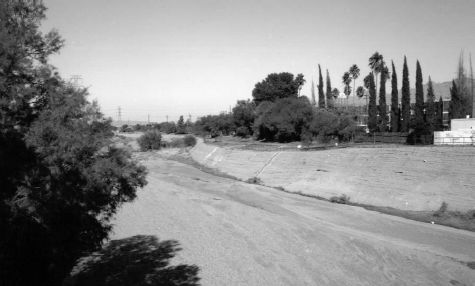 (December
17, 1994). The channel of the Santa Cruz River is now confined by soil-cemented
banks. The open gallery forest of cottonwood trees was destroyed by ground-water
pumpage and development, and the channel reached its present depth between
1977 and 1983 (Dominic Oldershaw, Stake 3300).
(December
17, 1994). The channel of the Santa Cruz River is now confined by soil-cemented
banks. The open gallery forest of cottonwood trees was destroyed by ground-water
pumpage and development, and the channel reached its present depth between
1977 and 1983 (Dominic Oldershaw, Stake 3300).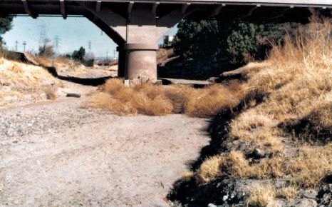
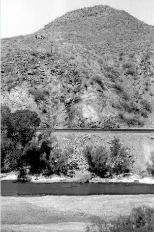
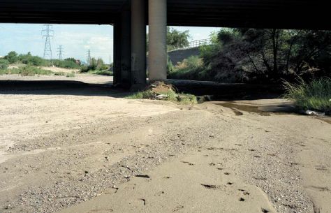 (August
22, 2000). The bridge was replaced, but its roadway surface was at about
the same elevation as the old one. Channel downcutting, which primarily
occurred during the 1977 and 1983 floods (the latter had a peak discharge
of 52,700 ft³/s), has lowered the bed by up to 9 feet. Because of persistent
problems with lateral channel change, soil cement now stabilizes the channel
banks (Dominic Oldershaw, Stake 298).
(August
22, 2000). The bridge was replaced, but its roadway surface was at about
the same elevation as the old one. Channel downcutting, which primarily
occurred during the 1977 and 1983 floods (the latter had a peak discharge
of 52,700 ft³/s), has lowered the bed by up to 9 feet. Because of persistent
problems with lateral channel change, soil cement now stabilizes the channel
banks (Dominic Oldershaw, Stake 298).