Skip Links

USGS - science for a changing world

Open-File Report 02-393

Spatial Digital Database for the Geology of the San Pedro River Basin in Cochise, Gila, Graham, Pima, and Pinal Counties, Arizona

By Karen S. Bolm

Thumbnail of and link to report PDF (2.4 MB)Summary

This spatial digital database for the geology of the San Pedro River Basin in southeastern Arizona was compiled from three maps by Dickinson (1993, 1998, 2000). Mylar originals of the map sheets were scanned, and the resultant images were rectified to a mathematically-generated set of latitude and longitude registration points. Geologic linework was digitized from the rectified images on screen using ArcView (ver. 3.2), and the resultant shapefiles were converted to ArcInfo (ver. 7.2) coverages. Lines and polygons were then attributed; and the files were merged omtp a single ArcInfo database (quib24k).

This digital spatial database is one of many being created by the U.S. Geological Survey as an ongoing effort to provide geologic information in a geographic information system (GIS) for use in spatial analysis. This database can be queried in many ways to produce a variety of geologic maps. Digital base map data files (topography, roads, towns, rivers and lakes, etc.) are not included: they may be obtained from a variety of commercial and government sources. This database is not meant to be used or displayed at any scale larger than 1:24,000 (for example, 1:12,000).

The map area is located in southeastern Arizona. This report describes the map units, the methods used to convert the geologic map data into a digital format, and the ArcInfo GIS file structures and relationships; and it explains how to download the digital files from the U.S. Geological Survey public access World Wide Web site on the Internet. See figures 2 and 3 for page-size versions of the map compilation.

First posted December 5, 2002

For additional information, contact:
Geology, Minerals, Energy, and Geophysics Science Center
U.S. Geological Survey
345 Middlefield Road, MS 901
Menlo Park, CA 94025-3591
http://geomaps.wr.usgs.gov/gmeg/

Part or all of this report is presented in Portable Document Format (PDF). For best results viewing and printing PDF documents, it is recommended that you download the documents to your computer and open them with Adobe Reader. PDF documents opened from your browser may not display or print as intended. Download the latest version of Adobe Reader, free of charge.


Suggested citation:

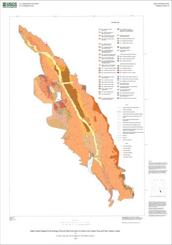
Bolm, Karen S., 2002, Spatial Digital Database for the Geology of the San Pedro River Basin in Cochise, Gila, Graham, Pima, and Pinal Counties, Arizona: U.S. Geological Survey Open-File Report 02-393, 36 pp., https://pubs.usgs.gov/of/2002/0393/.


Contents

Introduction

Description of map units

Data sources, processing, and accuracy

GIS documentation

Obtaining digitl data

Obtaining paper maps

References


Accessibility FOIA Privacy Policies and Notices

Take Pride in America logo USA.gov logo U.S. Department of the Interior | U.S. Geological Survey
URL: http://pubsdata.usgs.gov/pubs/of/2002/0393/index.html
Page Contact Information: GS Pubs Web Contact
Page Last Modified: Wednesday, 07-Dec-2016 19:27:42 EST