U.S. Geological Survey
Open-File Report 02-411
|
Multibeam Mapping of Selected Areas of the Outer Continental Shelf, Northwestern Gulf of Mexico--Data, Images, and GIS |
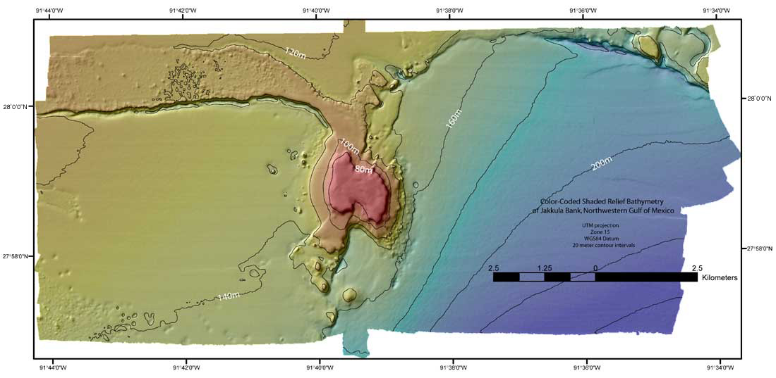
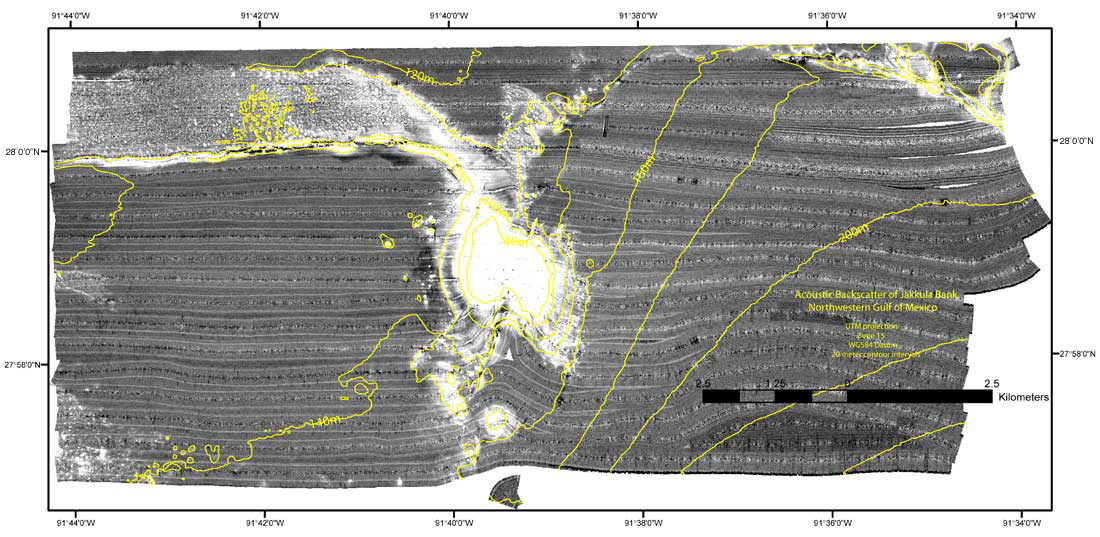
Jakkula Bank
|
Jakkula Bank was surveyed
in 2002 using a Kongsberg Simrad Field Activity metadata |

![]() U.S. Department of the Interior |
U.S. Geological Survey
U.S. Department of the Interior |
U.S. Geological Survey
URL: http://pubsdata.usgs.gov/pubs/of/2002/0411/wg-jakul.html
Page Contact Information: GS Pubs Web Contact
Page Last Modified: Wednesday, 07-Dec-2016 19:22:26 EST