Coastal & Marine Geology Program
>
Center for Coastal & Regional Marine Studies
> Environmental Atlas of Lake Pontchartrain
«
Return to Previous Page
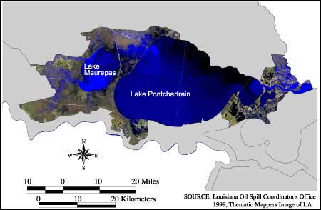
Figure 4:
Satellite image of Marginal Deltaic Basin Region (source: Louisiana Oil Spill Coordinator's Office, 1999, Thematic Mappers Image of LA).
«
Return to Previous Page
Coastal & Marine Geology Program
>
Center for Coastal & Regional Marine Studies
> Environmental Atlas of Lake Pontchartrain
email
Feedback
[an error occurred while processing this directive]