
![]()

Wisconsin Aeromagnetic and Gravity Maps and Data:
A Web Site for Distribution of Data
By David L. Daniels and Stephen L. Snyder
Open-File Report 02-493
Online only
2002
Wisconsin Composite Aeromagnetic
Anomaly Map at a simulated
flight altitude of 1000 feet above ground (North Illumination)
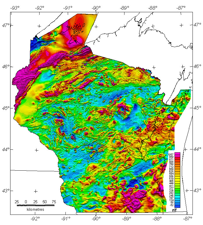
Grids for this map in several formats are available by using the "Get Data Files..." button.

Non-graphical version of this page
|| USGS - Eastern Minerals Team || USGS - Geology || USGS - Home Page || References ||