Open-File Report 2002-0049
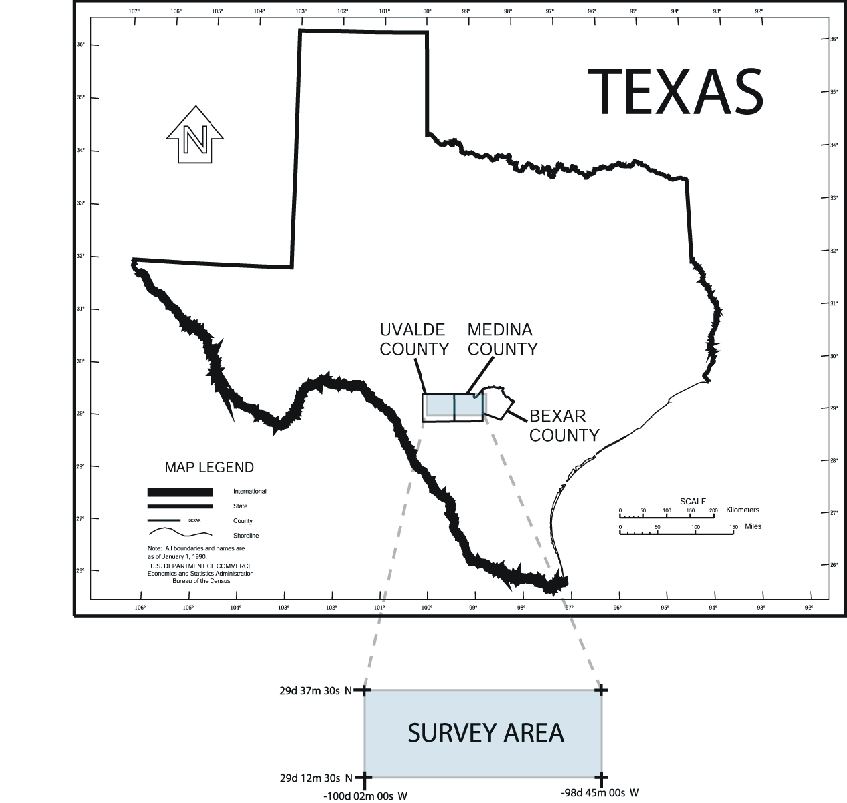
This map is an index to the location of the survey, which encompasses the area delimited by the corner coordinates:
The counties of Medina and Uvalde, west of San Antonio, Texas, are covered except for a strip bordering the western and southern boundary of the survey. A small area of western Bexar county was also included in the survey area.
The raw data and plots for this survey can be downloaded from links on the Main Page. For further information, read the "readme" text file in each directory before downloading.
The aeromagnetic map seen on the main page contains data from a high-resolution aeromagnetic survey flown in 2001 by Spectra Exploration Geoscience Corporation, under contract to the USGS. The contractor's report can be downloaded (129KB file here) in Adobe Acrobat PDF format.

![]() U.S. Department of the Interior |
U.S. Geological Survey
U.S. Department of the Interior |
U.S. Geological Survey
URL: http://pubsdata.usgs.gov/pubs/of/2002/ofr-02-0049/indexmap.html
Page Contact Information: GS Pubs Web Contact
Page Last Modified: Wednesday, 06-Dec-2023 07:08:07 EST
