
U.S. Geological Survey
Open-file Report 03-85
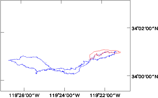
Nearshore Benthic Habitat GIS for the Channel Islands National Marine Sanctuary and Southern California State Fisheries Reserves Volume 1 |
|
||||||||||
http://geopubs.wr.usgs.gov/open-file/of03-85/n_ana/nanarsv.html
maintained by Carolyn Donlin
last modified 11 March 2003 (grc)
USGS Privacy Statement
| Disclaimer
| Feedback
| Accessibility
Department of the Interior U.S. Geological Survey Geologic Division Western Region Coastal & Marine Geology


