
U.S. Geological Survey
Open-file Report 03-85
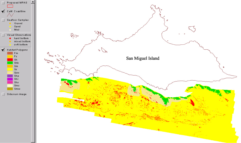
Nearshore Benthic Habitat GIS for the Channel Islands National Marine Sanctuary and Southern California State Fisheries Reserves Volume 1Habitat in the South San Miguel study area is rocky. Sidescan imaging was impeded in water depths less than 20 m by extensive kelp, which infers large areas of rock in those water depths. Rocky area persists out to the shelf break south of San Miguel Island. Extensive areas of sand waves suggest strong bottom currents are common in this area. |
|||||||||
 |
|||||||||
|
http://geopubs.wr.usgs.gov/open-file/of03-85/s_mig/smighab.html
maintained by Carolyn Donlin
last modified 11 March 2003 (grc)
USGS Privacy Statement | Disclaimer | Feedback | Accessibility
Department of the Interior U.S. Geological Survey Geologic Division Western Region Coastal & Marine Geology


