Open-File Report 03-120
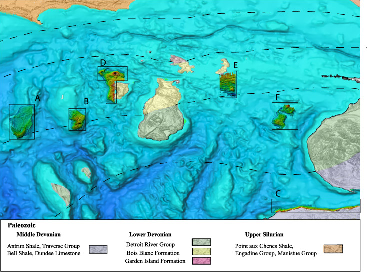
Figure 1. - Location map of 6 sites mapped with SHOALS system along with USGS 30-m topography and regional shaded bathymetry developed from Holocombe et. al., 1996. We also show the regional underlying Paleozoic geologic formations mapped on land and inferred offshore. (modified from Michigan DNR, 1987) A- Boulder Reef, B-Gull Island Reef, C-Little Traverse Bay, D-Trout Island Shoals, Trout Island and the west coast of High Island, E-Hog Island Shoal, F- Dahlia Shoal and Ile Aux Gallet. |

![]() U.S. Department of the Interior |
U.S. Geological Survey
U.S. Department of the Interior |
U.S. Geological Survey
URL: http://pubsdata.usgs.gov/pubs/of/2003/0120/bedrock.html
Page Contact Information: GS Pubs Web Contact
Page Last Modified: Wednesday, 02-Apr-2014 13:46:25 EDT
