USGS - science for a changing world

Open-File Report 03-120

Bathymetry and selected perspective views of 6 reef and coastal areas in Northern Lake Michigan.

Boulder Reef
 

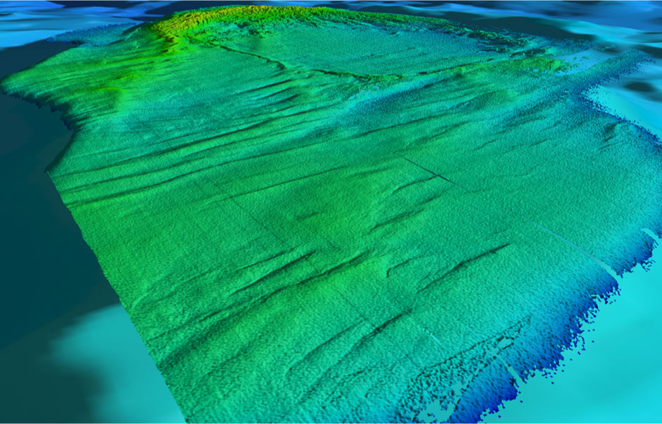
Figure 2.3 - Oblique view of Boulder Reef looking southwest emphasizes the east-west lineations and smoother morphology of a sand draped surface on the northern part of the reef. A "window" of gravel/cobbles is likely in the foreground at the northern edge of the map. Distance across the bottom of image is about 3.0 km.

shaded relief map of Boulder Reef, oblique view looking southwest


Accessibility FOIA Privacy Policies and Notices

Take Pride in America logo USA.gov logo U.S. Department of the Interior | U.S. Geological Survey
URL: http://pubsdata.usgs.gov/pubs/of/2003/0120/boulder2_3.html
Page Contact Information: GS Pubs Web Contact
Page Last Modified: Wednesday, 02-Apr-2014 14:44:10 EDT