Open-File Report 03-120
|
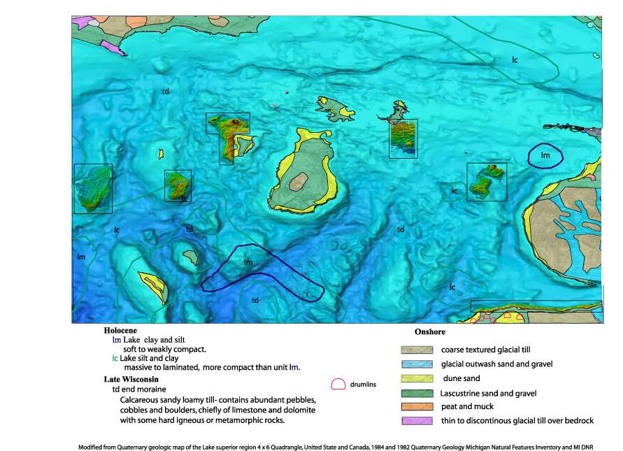
Figure 3. - Modified from Quaternary geologic map of Lake Superior region 4° x 6° Quadrangle, United State and Canada, showing areas mapped with high resolution LIDAR morphology and onshore topography, 1984 and 1982 Quaternary Geology Michigan Natural Features Inventory and MI DNR. |

![]() U.S. Department of the Interior |
U.S. Geological Survey
U.S. Department of the Interior |
U.S. Geological Survey
URL: http://pubsdata.usgs.gov/pubs/of/2003/0120/quaternary.html
Page Contact Information: GS Pubs Web Contact
Page Last Modified: Wednesday, 02-Apr-2014 16:02:02 EDT
