Open-File Report 03-120
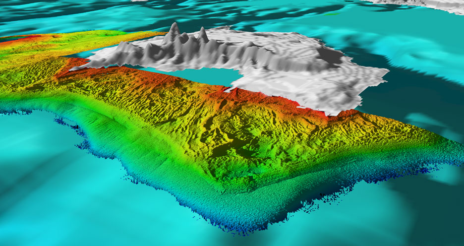
Trout Island Shoals and High Island Reef Figure 5.2 - Oblique perspective looking northeast along the west coast of High Island. The rough morphology nearshore (glacial or Bois Blanc Formation) is similar in texture and trend to Gull Island reef (Figure 3.1).This relief abruptly changes to a smooth (sand?) bottom along a 2-3m scarp at about 10 m water depth the bottom of this scarp may represent the location of a previous (glacial?) shoreline. This sharp transition and shoreline-like? feature is not obvious at other mapped sites. Distance across the foreground of this perspective is 5.0 km. |

![]() U.S. Department of the Interior |
U.S. Geological Survey
U.S. Department of the Interior |
U.S. Geological Survey
URL: http://pubsdata.usgs.gov/pubs/of/2003/0120/trout_high5_2.html
Page Contact Information: GS Pubs Web Contact
Page Last Modified: Wednesday, 02-Apr-2014 16:09:49 EDT
