Open-File Report 03-265
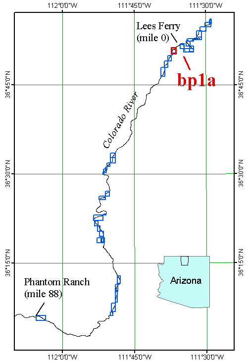
Grand Canyon Riverbed Sediment Changes, Experimental Release of September 2000 - A Sample Data SetFigure 3. State of Arizona and Colorado River index maps indicating study area and location of segments of USGS surveys. The highlighted box is the area of segment "bp1a", data from below the Paria River confluence, which are presented in this poster. All maps in Arizona State Plane Coordinate System, FIPS 202, NAD83. |

![]() U.S. Department of the Interior |
U.S. Geological Survey
U.S. Department of the Interior |
U.S. Geological Survey
URL: http://pubsdata.usgs.gov/pubs/of/2003/0265/f03indexmap.html
Page Contact Information: GS Pubs Web Contact
Page Last Modified: Friday, 04-Apr-2014 12:39:26 EDT