Open-File Report 03-265
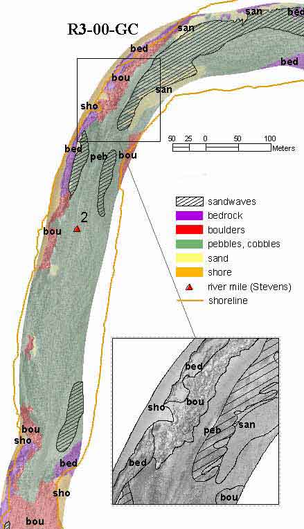
Grand Canyon Riverbed Sediment Changes, Experimental Release of September 2000 - A Sample Data SetFigure 6. Colorado riverbed conditions near mile 2 below the confluence of the Paria River before the September 2000 experimental release from Glen Canyon Dam. Bedrock, boulders, pebbles or cobbles, sand, and shoreline (r300bp1a) interpreted from sidescan sonar image (r300bp1a2.tif). Bedforms or sandwaves (r300bp1asw) are indicated in hachured overlay. Inset: Enlargement of a part of the R3-00-GC sidescan image with the boundaries of the interpreted polygons. Width of inset 125 m.
|

![]() U.S. Department of the Interior |
U.S. Geological Survey
U.S. Department of the Interior |
U.S. Geological Survey
URL: http://pubsdata.usgs.gov/pubs/of/2003/0265/f06r300.html
Page Contact Information: GS Pubs Web Contact
Page Last Modified: Friday, 04-Apr-2014 12:39:01 EDT