Open-File Report 03-265
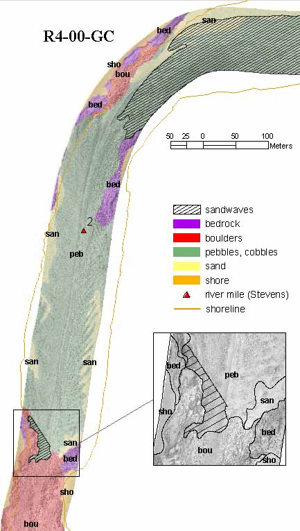
Grand Canyon Riverbed Sediment Changes, Experimental Release of September 2000 - A Sample Data SetFigure 7. Colorado riverbed after the September 2000 release. Same bottom types as for R3-00-GC overlaid on sidescan sonar image (r400bp1a.tif). The apparent spread of riverbed features beyond the shoreline is a result of the uncertain navigation data in parts of the canyon. Inset: Enlargement of a part of the R4-00-GC sidescan image with the boundaries of the interpreted polygons. Width of inset 100 m.
|

![]() U.S. Department of the Interior |
U.S. Geological Survey
U.S. Department of the Interior |
U.S. Geological Survey
URL: http://pubsdata.usgs.gov/pubs/of/2003/0265/f07r400.html
Page Contact Information: GS Pubs Web Contact
Page Last Modified: Friday, 04-Apr-2014 12:38:52 EDT