USGS - science for a changing world

Open-File Report 03-441

DATA REPORT - Geology of Reef-Front Carbonate Sediment Deposits around Oahu, Hawaii

Introduction
Methods
Metadata
Data
Maps
Geostatistical Analysis
    of Sediment Thickness
References
Table of Contents


Maps

Figure 1: Oahu location map
Sediment Thickness
  Kailua (113 kb)
  Leeward coast (129 kb)
  North coast (77 kb)
Vibracore locations
  Kailua 1997 (111 kb)
  Kailua 2000 (109 kb)
  Leeward coast
  North coast
  South coast
Beach sample locations
  Kailua (342 kb)
  Oahu
Subbottom profile tracklines
  Kailua (113 kb)
  Leeward coast
  North coast
Sidescan sonar map
  South coast

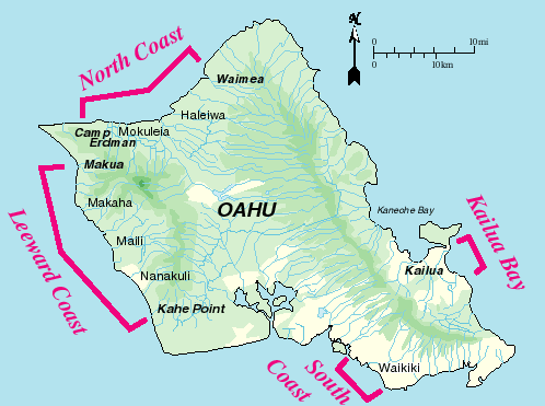
Figure 1: Oahu Location Map

Oahu, Hawaii map showing locations of study areas: North Coast, Leeward Coast, Kailua Bay, and South Coast


Accessibility FOIA Privacy Policies and Notices

Take Pride in America logo USA.gov logo U.S. Department of the Interior | U.S. Geological Survey
URL: http://pubsdata.usgs.gov/pubs/of/2003/0441/maps.html
Page Contact Information: GS Pubs Web Contact
Page Last Modified: Tuesday, 10-Jan-2017 12:22:30 EST