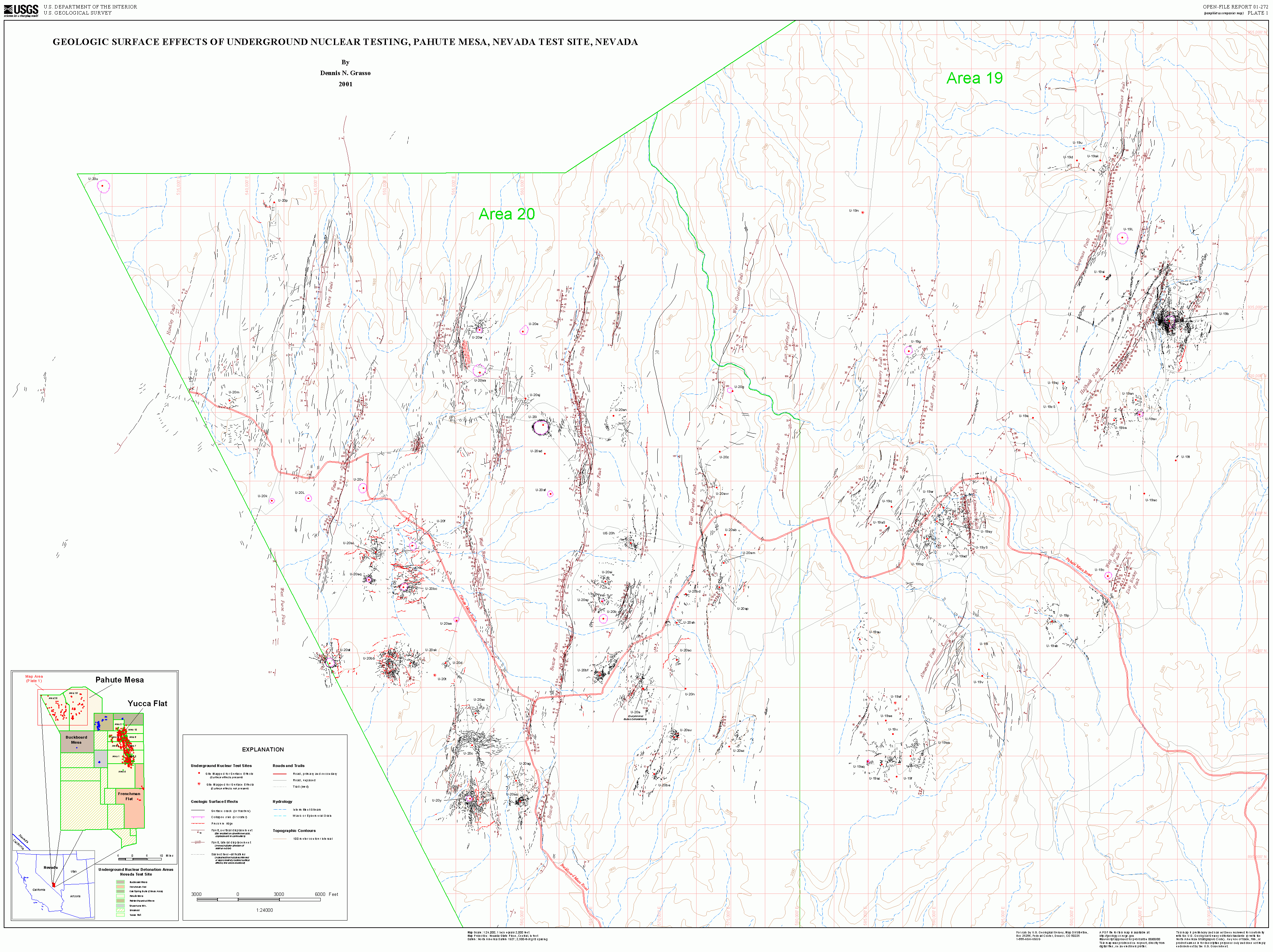
Pahute Mesa: GIS Surface Effects Map |
| OFR 01-272 (Plate 1): This large-scale map
displays the surface
effects mapped for all detonations conducted within the Pahute Mesa
testing area. Surface effects include
collapse sinks, cracks, named and unnamed faults, and
pressure ridges. Red dots and stars are
detonation mapped for surface effects. The map explanation (lower left) provides a
description of all map features. PAN MAP down and to right ==> |
|