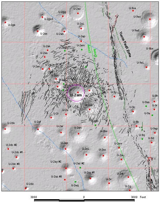
Surface Effects Map: Site U-2am |
| Explanation: This map shows the surface effects for detonation site U-2am. Click on the collapse sink to view a high-resolution, low-altitude aerial photograph of the sink edge and associated cracks. Red dots indicate detonation sites that have surface effects maps; green dots indicate that no surface effects data are available for the site. |
 |