Topographic Effects of Testing: Shaded Relief |
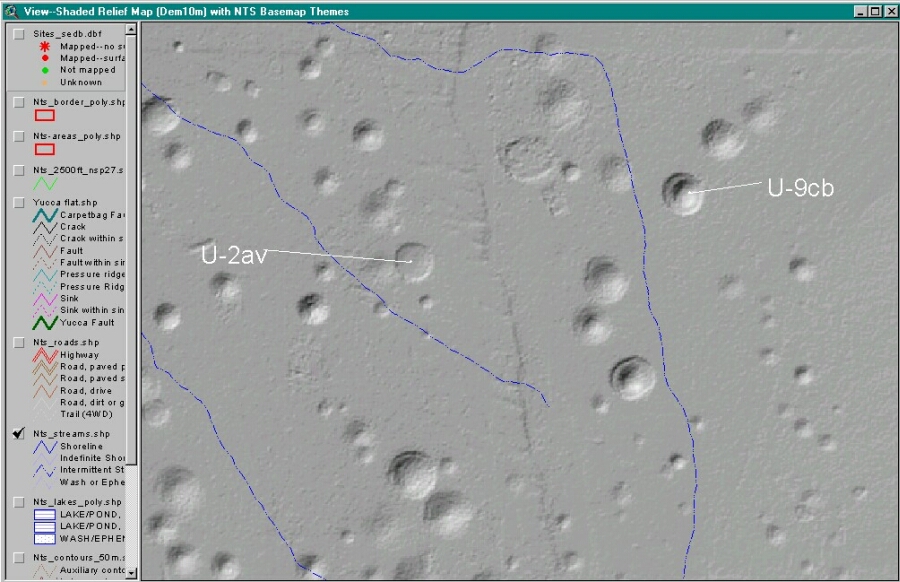
| Explanation: This map shows the topographic effects of underground nuclear testing along the Yucca Fault Zone in Areas 2 and 9, Yucca Flat. The map was produced
using a 10-meter resolution shaded relief map. Blue lines are ephemeral drainages based on
1:100,000-scale USGS DLG map data. The map is a screen capture of an ArcView
(v. 3.2) view window. View this map with the GIS surface effects overlay map |
|
|