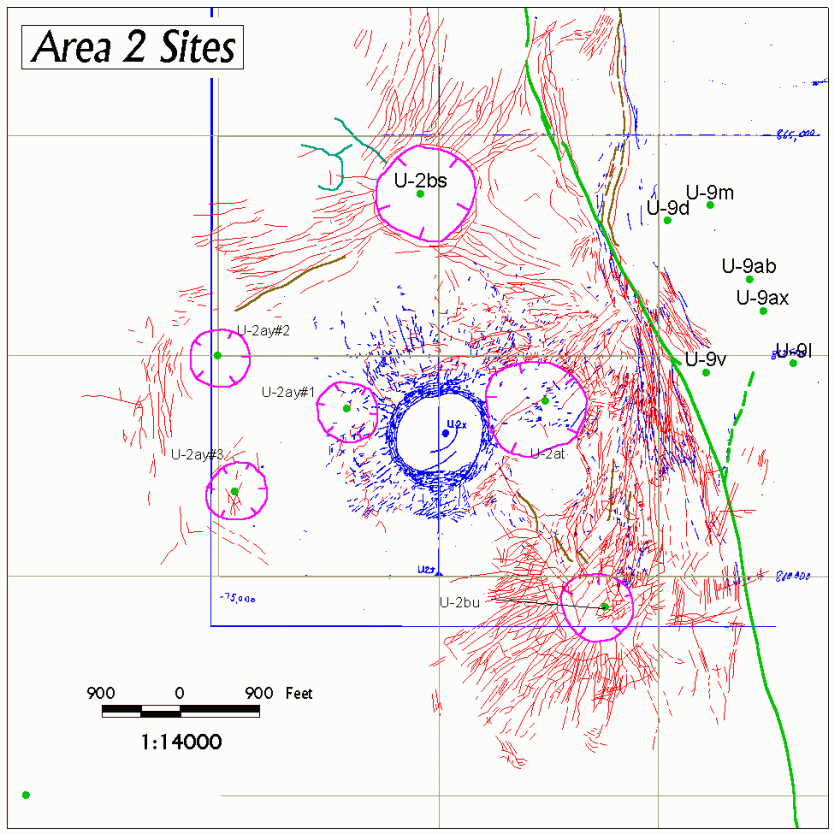
Site U-2x: GIS Work in Progress |
| Explanation: Work in progress on U-2x. The
scanned, original (mylar) map is displayed in blue. Completed GIS surface effects
of the surrounding sites are
displayed as: Sinks (magenta), cracks
(red), pressure ridges (turquoise), and faults (green). Green
dots are completed detonation sites (labeled). Note the accuracy of the grid (blue) on the original map
as compared to the 2,500-foot, Nevada State Plane GIS grid (light gray). The
heavier vertical and horizontal blue lines are the edges of the scanned map,
not grid lines. View the completed site |
|
|