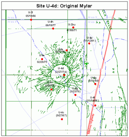
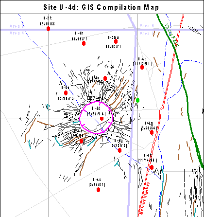
| Explanation: These maps show
the surface effects caused by the Latir (U-4d) detonation in the Yucca
Flat testing area of the Nevada Test Site. The original hand-drawn “mylar” map
(left) is compared to the GIS digital reproduction (right). Red and green dots
are detonation sites that were mapped and not mapped for surface
effects, respectively. Symbols and colors depicting GIS surface effects
are: Sink (magenta), crack (black), fault (brown), pressure ridge (turquoise), and Yucca Fault (green).
Mercury Highway trends north-south at right on maps. |