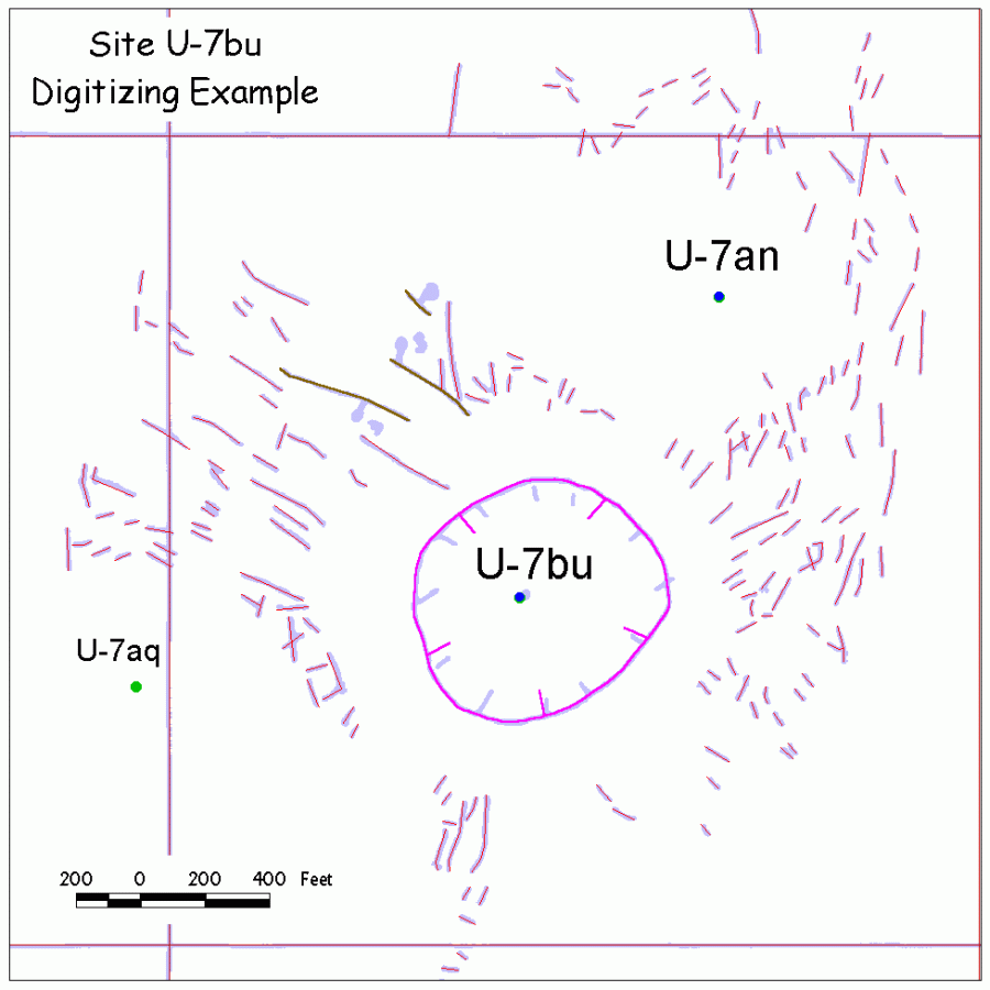
Site U-7bu: GIS Surface Effects Map |
| Explanation: This map illustrates the level of accuracy
of the digital surface effects maps. Look closely! The digital surface effects are displayed as colored vectors
over the scanned and georeferenced original surface effects map (heavy
light-blue lines) for detonation site U-7bu. Surface effects include: cracks
(red), collapse sink (magenta), and faults (dark brown); digital fault
symbols are not shown. The Nevada State Plane digital reference grid is
displayed in red. What to look for: Notice that the heavy light-blue lines of the original map form a thin border around the digital lines. This indicates a very good spatial fit, and hence, a very accurate map. Also notice that the sink-hole symbols (down-dip hachures) are better organized and evenly spaced compared to the original map. |
|
|