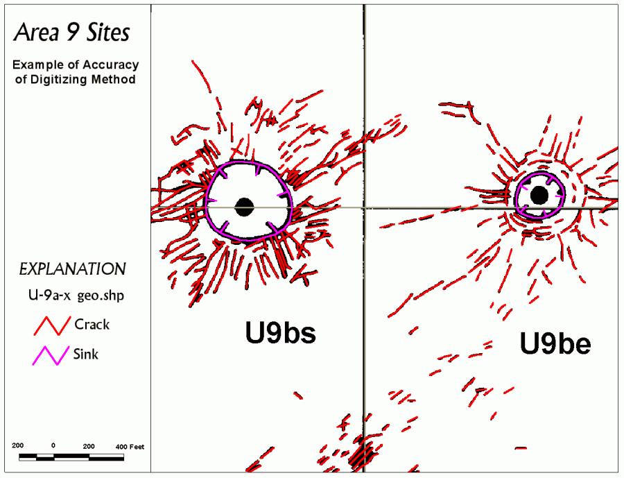
Sites U-9bs and U-9be: GIS Surface Effects Map |
| Explanation: The spatial (horizontal) error
of the digital surface effects ranges from 0.1 to 1.0 meter on the ground
compared to the original maps. This means that the lines (vectors) that represent the different surface effects
are no more than 1/1,000th to 1/250th of an inch in error when displayed on a 1:12,000-scale map.
Look closely at this map. The digital surface effects are displayed in
color
over the scanned and georeferenced original surface effects map (heavy
black lines) for detonation sites U-9bs and U-9be. The Nevada State Plane
digital reference grid is displayed in gray.
What to look for: Notice that the heavy black lines of the original map form a thin border around the digital lines. This indicates a very tight spatial fit, and hence, a very accurate map. Also notice that some of the heavy black lines on the original map have merged. This is caused by: (1) the variable line weights (pen sizes) on the original hand-drawn map, and (2) the thickening and coalescing of lines caused by scanning. |
|
|