Shaded Relief Map, Nevada Test Site Area |
|
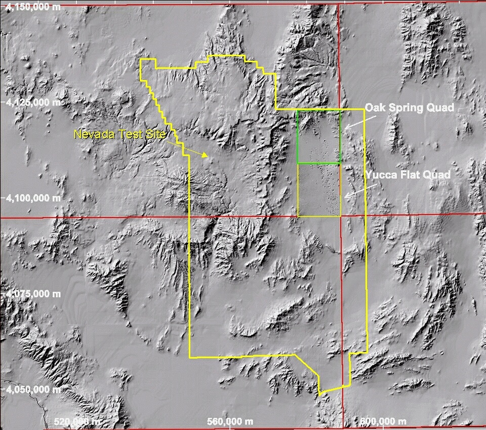
Explanation: Shaded relief map prepared as a mosaic of four 1:100,000-scale maps--Pahute Mesa, Pahranagat Range, Indian Springs, and Beatty (clockwise from northwest). Yucca Flat is shown using higher-resolution, 1:24,000-scale maps--Oak Spring and Yucca Flat quads (green and yellow borders). Note that individual collapse sinks and craters are visible. Map coordinates: UTM, NAD27, Zone 11, in meters. Click here to Zoom In over Yucca Flat. |
|