The bathymetry data set included with this publication is associated with a marine data collection activity referred to by the USGS/CMG Activity ID: A-1-97-GM
A version of this metadata was orginally written for the bathymetry and backscatter grids by Peter N. Schweitzer (pschweitzer@usgs.gov) USGS - Reston, VA for Dartnell & Gardener (1999) USGS DDS-55 for TIFF images of the bathymetry and seafloor backscatter for the Flower Gardens National Marine Sanctuary. The existing metadata was modified to describe the bathymetry and backscatter rasters included on Scanlon, Ackerman & Rozycki (2003) USGS 03-002.
Ackerman, Seth D. , and Scanlon, Kathryn M. , 2003, ef_hlshd: Open-File Report 03-002, U.S. Geological Survey, Woods Hole, MA.This is part of the following larger work.Online Links:
- http://pubs.usgs.gov/of/2003/of03-002/
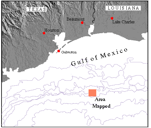
Scanlon, Kathryn M. , Ackerman, Seth D. , and Rozycki, Jill E. , 2003, Texture, Carbonate Content, and Preliminary Maps of Surficial Sediments of the Flower Garden Banks Area, Northwestern Gulf of Mexico Outer Shelf.: Open-File Report 03-002, U.S. Geological Survey, Woods Hole, MA.Online Links:
This is a Raster data set. It contains the following raster data types:
Horizontal positions are specified in geographic coordinates, that is, latitude and longitude. Latitude and longitude values are specified in Decimal degrees.
The horizontal datum used is North American Datum of 1983.
The ellipsoid used is Geodetic Reference System 80.
The semi-major axis of the ellipsoid used is 6378137.000000.
The flattening of the ellipsoid used is 1/298.257222.
Sequential unique whole numbers that are automatically generated.
Seth Ackerman
U.S. Geological Survey
USGS - Woods Hole Field Center
Woods Hole, MA 02543
USA
508.548.8700 x2315 (voice)
508.457.2310 (FAX)
sackerman@usgs.gov
These data and information are intended for science researchers, students from elementary through college, policy makers, and general public.
Person who carried out this activity:
Seth Ackerman
US Geological Survey
USGS - Woods Hole Field Center
Woods Hole, MA 02543
USA
508.548.8700 x2315 (voice)
508.457.2310 (FAX)
sackerman@usgs.gov
Person who carried out this activity:
Seth Ackerman
US Geological Survey
USGS - Woods Hole Field Center
Woods Hole, MA 02543
USA
508.548.8700 x2315 (voice)
508.457.2310 (FAX)
sackerman@usgs.gov
Person who carried out this activity:
Seth Ackerman
U.S. Geological Survey
USGS - Woods Hole Field Center
Woods Hole, MA 02543
USA
508.548.8700 x2315 (voice)
508.457.2310 (FAX)
sackerman@usgs.gov
Person who carried out this activity:
Seth Ackerman
US Geological Survey
USGS - Woods Hole Field Center
Woods Hole, MA 02543
USA
508.548.8700 x2315 (voice)
508.457.2310 (FAX)
sackerman@usgs.gov
United States Geological Survey, Coastal and Marine Geology (CMG), Unknown, USGS/CMG Information Bank.Online Links:
Complete for the timeframe of original publication
Are there legal restrictions on access or use of the data?
- Access_Constraints: Physical materials are under controlled on-site access.
- Use_Constraints:
- Please recognize the U.S. Geological Survey (USGS) as the source of this information. Physical materials are under controlled on-site access. Some USGS information accessed through this means may be preliminary in nature and presented without the approval of the Director of the USGS. This information is provided with the understanding that it is not guaranteed to be correct or complete and conclusions drawn from such information are the responsibility of the user. This information is not intended for navigational purposes. Any use of trade, firm, or product names is for descriptive purposes only and does not imply endorsement by the U.S. Government.
USGS Information
Box 25286 Denver Federal Center
Denver, CO 80225
USA
1-888-ASK-USGS (voice)
303-202-4693 (FAX)
ask@usgs.gov
USGS Open File Report 03-002
Neither the United States Government nor any agency thereof, nor any of their employees, makes any warranty, expressed or implied, or assumes any legal liability or responsibility for the accuracy, completeness, or usefulness of any information, apparatus, product, or process disclosed in this report, or represents that its use would not infringe privately owned rights. Reference therein to any specific commercial product, process, or service by trade name, trademark, manufacturer, or otherwise does not necessarily constitute or imply its endorsement, recommendation, or favoring by the United States Government or any agency thereof.Although all data and software published in this report have been used by the USGS, no warranty, expressed or implied, is made by the USGS as to the accuracy of the data and related materials and (or) the functioning of the software. The act of distribution shall not constitute any such warranty, and no responsibility is assumed by the USGS in the use of this data, software, or related materials.
| Data format: | Seafloor bathymetry and backscatter in format TIFF (version 6.0) Size: 4.345 |
|---|---|
| Network links: |
<http://geopubs.wr.usgs.gov/dds/dds-55/pacmaps/tiffs/wf_bathy.tif.gz> <http://geopubs.wr.usgs.gov/dds/dds-55/pacmaps/tiffs/wf_back.tif.gz> |
| Data format: | Seafloor bathymetry and backscatter in format ArcInfo export (GRID) (version 7.2.1) Size: 4.345 |
|---|---|
| Network links: |
<http://geopubs.wr.usgs.gov/dds/dds-55/pacmaps/exports/wf_bathy.e00.gz> <http://geopubs.wr.usgs.gov/dds/dds-55/pacmaps/exports/wf_back.e00.gz> |
Seth Ackerman
U.S. Geological Survey
USGS - Woods Hole Field Center
Woods Hole, MA 02543
USA
508.548.8700 x2315 (voice)
508.457.2310 (FAX)
sackerman@usgs.gov