U.S. Geological Survey Open-File Report 03-039
Figure 2
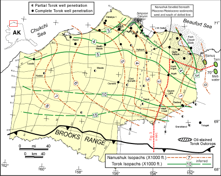
Figure 2. Map of NPRA showing grid of seismic lines used in this study, generalized Torok and Nanushuk thickness contours (from Bird, 1988), locations of wells that penetrate Torok Formation, locations of cross section shown in Fig. 3.
[an error occurred while processing this directive]