U.S. Geological Survey Open-File Report 03-039
Figure 9
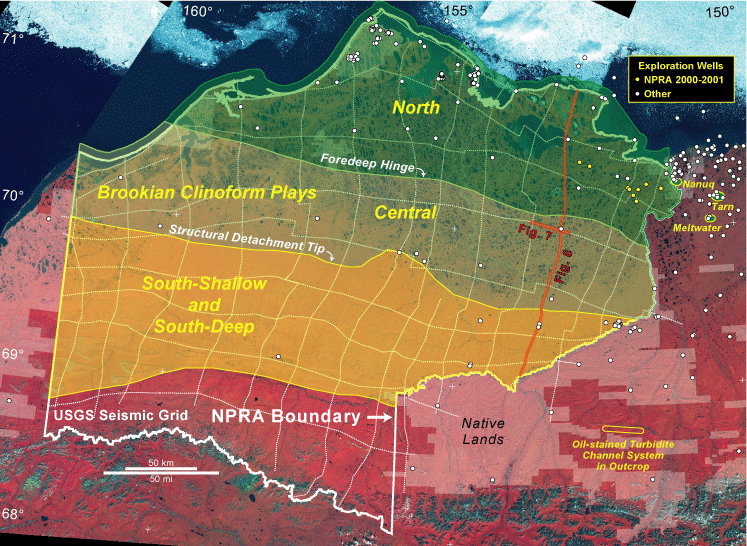
Figure 9. Map of Brookian clinoform play areas, regional seismic lines, and well control in and near NPRA. Note that boundary between north and central play areas is defined by the foredeep hinge line, and that boundary between central and south play areas is defined by the structural detachment tip line. Note location of seismic line segments shown in Figs. 7 and 8.
[an error occurred while processing this directive]