U.S. Geological Survey Open-File Report 03-040
Figure 2

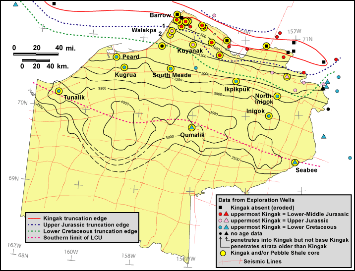
Figure 2. Map of the NPRA showing generalized total thickness of Kingak Shale
(derived from depth-converted seismic data), wells that penetrate Kingak Shale
with symbols indicating age of uppermost strata and core control, names of selected
wells, and approximate truncation edges of chronostratigraphic intervals. Grid of 2-D seismic data interpreted as a basis
for assessing the undiscovered petroleum potential of Beaufortian strata also
is shown. Note that only selected wells
are shown outside NPRA.