U.S. Geological Survey Open-File Report 03-040
Figure 7A
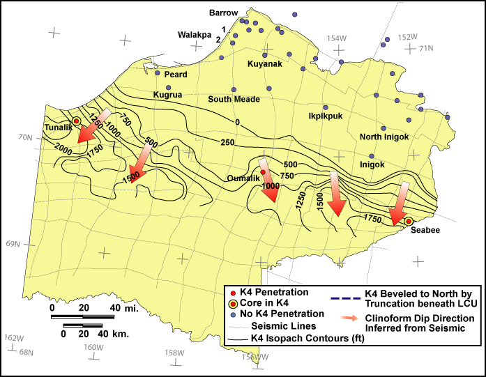
Figure 7A. Map of the NPRA showing generalized thickness
(in feet) of Beaufortian sequence set K4, public domain seismic grid used to
map sequence sets, well penetrations of K4, and wells with public domain cores
in K4. Arrows indicate dip directions
of K4 clinoforms, with base and tip of each arrow showing approximate updip
(proximal) and downdip (distal) extent of clinoforms.