
![]()
Morven Park AMT Electrical Section
![]()
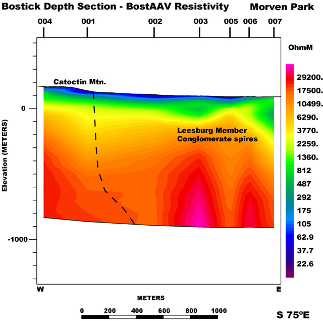
The Morven Park electrical section was compiled using data from 7 AMT sites. The profile is roughly normal to the Culpeper Basin western bounding fault on the Waterford and Leesburg 7.5' quadrangles, Virginia. These data were collected during the spring of 2001 to investigate a limestone conglomerate aquifer and western bounding fault. A spring near the base of Catoctin Mountain provided water to the plantation. This location has some of the lowest near surface resistivities. The spring is just west of AMT station 001. MT parameters were calculated from impedances and plotted on a projected line that trends S75E. Elevation corrections were applied to each station using the USGS 30 m DEM and no vertical exaggeration was applied. The data were smoothed, interpolated, and gridded using minimum curvature techniques to generate the electrical section. The black line is the interpreted location of the bounding fault. The AMT data are available as cross- power, spectra or impedance files in the data section.
|| Culpeper Basin AMT || USGS - Eastern Earth Surface Processes Team || USGS - Geology || USGS ||
Contact: Herbert A. Pierce
[an error occurred while processing this directive]