
![]()
Rapidan AMT Electrical Sections
![]()
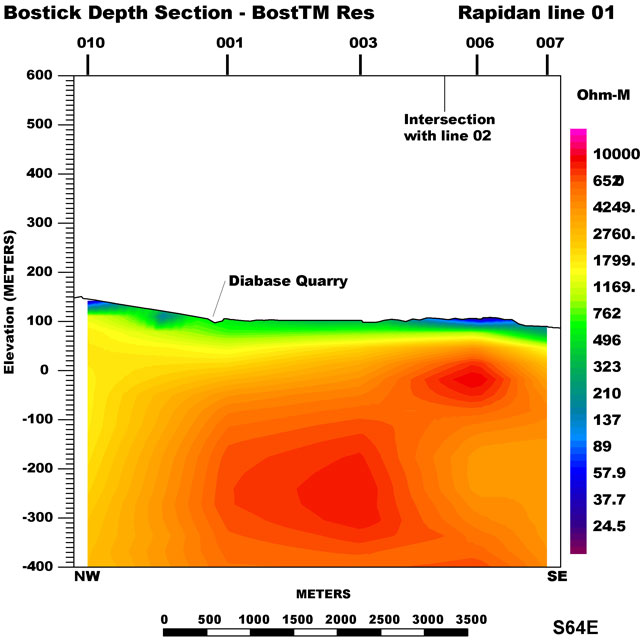
The Rapidan electrical section was compiled using data from 5 AMT sites northwest of the Rapidan River south of Culpeper, Virginia. These data were collected during the spring of 2001 and 2002. The section crosses the Rapidan lopolith that appears to be about 550 m thick. MT parameters were calculated from impedances and plotted on a projected line that trends S64E. Elevation corrections were applied to each station using 30m USGS DEM with vertical exaggeration applied. The data were smoothed, interpolated, and then gridded using minimum curvature techniques to generate the electrical section. The AMT data are available as cross-power, spectra or impedance files in the data section.
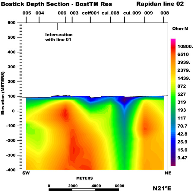
This northeast-southwest Rapidan electrical section was compiled using data from 9 AMT sites. These data were collected during the spring of 2001 and 2002. MT parameters were calculated from impedances and plotted on a projected line that trends N21S. Elevation corrections were applied to each station using 30m USGS DEM with vertical exaggeration applied. The data were smoothed, interpolated, and then gridded using minimum curvature techniques to generate the electrical section. The AMT data are available as cross-power, spectra or impedance files in the data section.
|| Culpeper Basin AMT || USGS - Eastern Earth Surface Processes Team || USGS - Geology || USGS ||
Contact: Herbert A. Pierce
[an error occurred while processing this directive]