
![]()
Selma Plantation AMT Electrical Section
![]()
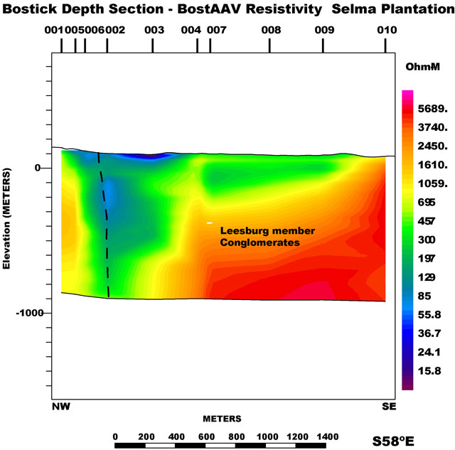
The Selma Plantation electrical section was compiled using arithmetic averaged data from 10 AMT sites north of Leesburg near the Potomac River in Loudoun County. These data were collected during the spring of 2001 to map the conglomerates near the western bounding fault. MT parameters were calculated from measured impedances and plotted on a projected line that trends S58°E. Elevation corrections were applied to each station using the USGS 30m DEM and no vertical exaggeration applied. The data were smoothed, interpolated, and gridded using minimum curvature techniques to generate the electrical section. The black line on the left is the interpreted location of the western bounding fault. The AMT data are available as cross- power, spectra or impedance files in the data section.
|| Culpeper Basin AMT || USGS - Eastern Earth Surface Processes Team || USGS - Geology || USGS ||
Contact: Herbert A. Pierce
[an error occurred while processing this directive]