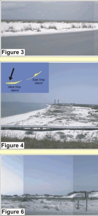
Figure 3: Dominant geomorphology of Santa Rosa Island (5-very high vulnerability), here elevation is low from the Gulf (right) to Pensacola Bay (left).
Figure 4: West Ship Island looking east from Civil War era Fort Massachusetts. The geomorphology is characterized as a low elevation overwashed barrier island (5- very high vulnerability).
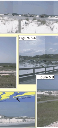
Figure 5: A) Langdon Battery near Fort Pickens appears to set on top of a large dune, however the elevation is artificial from old gun emplacements. B) view from the top of Langdon Battery.
Figure 6: Dune ridge (4- high vulnerability) adjacent to washover (5- very high vulnerability) on Santa Rosa Island.
|