Skip past header information USGS Logo with link to USGS web page
Coastal Vulnerability Assessment of GUIS, USGS Open-File Report 03-108


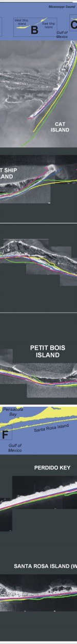
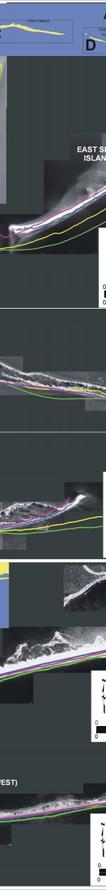
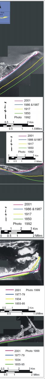
Figure 7. Historic Shoreline positions for A) Cat Island, B) East and West Ship Island, C) Horn Island, D) Petit Bois Island, E) Perdido Key, and E) Western Santa Rosa Island.


Figure 7:  Historic Shoreline positions for A) Cat Island, B) East and West Ship Island, C) Horn Island, D) Petit Bois Island, E) Perdido Key, and E) Western Santa Rosa Island. Figure 7:  Historic Shoreline positions for A) Cat Island, B) East and West Ship Island, C) Horn Island, D) Petit Bois Island, E) Perdido Key, and E) Western Santa Rosa Island. Figure 7:  Historic Shoreline positions for A) Cat Island, B) East and West Ship Island, C) Horn Island, D) Petit Bois Island, E) Perdido Key, and E) Western Santa Rosa Island.
Figure 7:  Historic Shoreline positions for A) Cat Island, B) East and West Ship Island, C) Horn Island, D) Petit Bois Island, E) Perdido Key, and E) Western Santa Rosa Island.

Skip Footer Information
Department of Interior
 /  U.S. Geological Survey  /  Coastal and Marine Geology / 

USGS Privacy Statement  /  Disclaimer  /  Accessibility
This is http://pubs.usgs.gov/pubs/of/2003/of03-108/html/fig7.html
Maintained by Eastern Publications Group
Modified Saturday, 12-Jan-2013 23:45:05 EST