Skip past header information USGS Logo with link to USGS web page
Coastal Vulnerability Assessment of GUIS, USGS Open-File Report 03-108


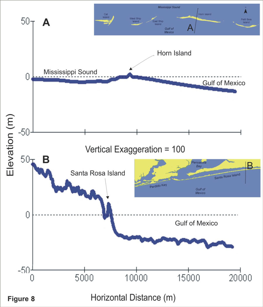
Figure 8. Regional coastal slope cross-section of A) Horn Island (5 - very high vulnerability). B) Santa Rosa Island (3 - moderate to 2 - low vulnerability). The low vulnerability portion of Santa Rosa is shown in the profile.


Figure 8:  Regional coastal slope cross-section of A) Horn Island (5 - very high vulnerability).  B) Santa Rosa Island (3 - moderate to 2 - low vulnerability).

Skip Footer Information
Department of Interior
 /  U.S. Geological Survey  /  Coastal and Marine Geology / 

USGS Privacy Statement  /  Disclaimer  /  Accessibility
This is http://pubs.usgs.gov/pubs/of/2003/of03-108/html/fig8.html
Maintained by Eastern Publications Group
Modified Saturday, 12-Jan-2013 23:45:06 EST