|
|
|
|
|
| Report Home | Maps | Overview | Mapping Methods | Coastal Classifications | Geologic Setting | Coastal Processes | Coastal Vulnerability | Classification Summary | References | |||||||||||||||||||||||||||||||
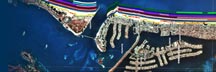
Geologic SettingThe west-central coast of Florida between Anclote Key and Venice Inlet consists of sandy beaches and narrow barrier islands. A prominent physiographic feature is the broadly arcuate headland at Indian Rocks Beach where the Gulf shore and mainland meet. The Gulf shoreline changes orientation around this promontory because the headland is composed of Miocene sandstone, which resists erosion. The coast north and south of the headland is characterized by barrier islands of variable dimensions separated by tidal inlets of variable dimensions (Davis, 1994). The sand that makes up the beaches and barriers overlies a hard limestone platform that forms the adjacent continental shelf (Locker et al., 1999). The limestone is exposed on the shelf or covered by a thin veneer of sand and shell. The beach sand typically contains abundant broken shell material as a result of high production of mollusks in the clear warm water of the Gulf of Mexico and an absence of rivers that would supply additional sand. Shells are also concentrated on beaches by the offshore dredging and hydraulic pumping associated with beach nourishment projects, which are common along this coastal region. |