Skip past header information
USGS Logo with Link to USGS Home Page
High-resolution seismic-reflection surveys in the nearshore of outer Cape Cod, Massachusetts, USGS Open-File Report 03-235
Back to Title Page

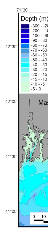
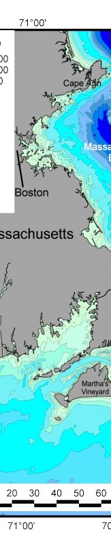
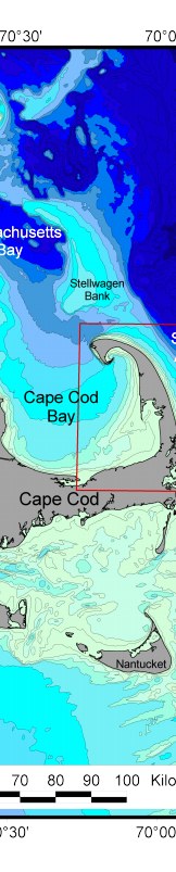
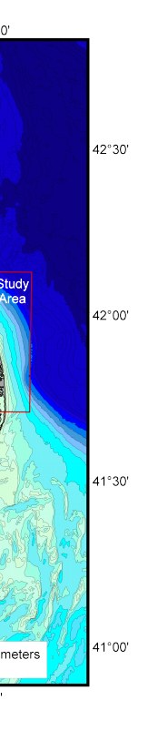
Figure 1. Index map of eastern Massachusetts showing the lower Cape Cod study area. Bathymetry processed by Mass GIS, Executive Office of Environmental Affairs (www.state.ma.us/mgis/bathymgm.htm).

Click on figure for larger image (PDF format 3706 KB).

Figure 1. Index map of eastern Massachusetts showing the lower Cape Cod study area. Figure 1. Index map of eastern Massachusetts showing the lower Cape Cod study area. Figure 1. Index map of eastern Massachusetts showing the lower Cape Cod study area. Figure 1. Index map of eastern Massachusetts showing the lower Cape Cod study area.


Adobe Acrobat Reader To view files in PDF format, download free copy of Adobe Acrobat Reader.


Skip Footer Information
Department of Interior
 /  U.S. Geological Survey  /  Coastal and Marine Geology / 

U.S.G.S. Privacy Statement  /  Disclaimer  /  Accessibility
This is http://pubs.usgs.gov/pubs/of/2003/of03-235/html/fig1.html
Maintained by Eastern Publications Group
Modified Saturday, 12-Jan-2013 23:24:51 EST