High-resolution seismic-reflection surveys in the nearshore of outer Cape Cod, Massachusetts, USGS Open-File Report 03-235
Back to Title Page
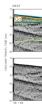
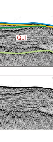
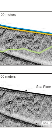
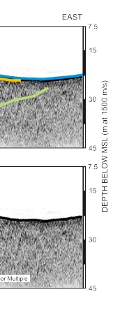
Figure 7. Chirp profile showing well stratified glacial drift interpreted to be glaciolacustrine deposits (Qdl). The unit has an apparent landward dip. The deformation of the stratified unit to the east may indicate it was deposited in close proximity to the South Channel lobe. The light green horizon is interpreted to be the base of the glaciolacustrine. The dark green horizon is the top of the unit where there is a facies change to non-stratified glacial drift (Qd). The yellow horizon is the Holocene transgressive unconformity. This surface truncates Qdl to the east. See figure 2 for location of Chirp profile.
Click on figure for larger image (PDF format 1044 KB).
 |
 |
 |
 |
![]() To view files in PDF format, download free copy of Adobe Acrobat Reader.
To view files in PDF format, download free copy of Adobe Acrobat Reader.
