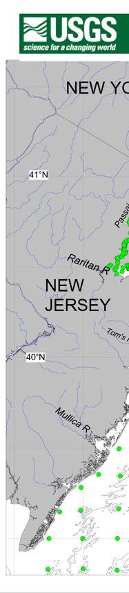
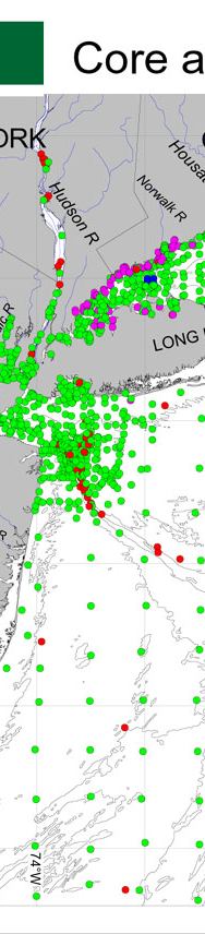
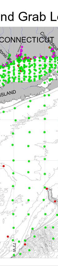
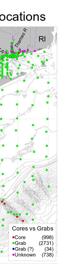
Contaminated Sediments Database for Long Island Sound and the New York Bight, USGS Open-File Report 03-241
The map shows the distribution of the samples in the database by location and sample type (cores and grabs).
U.S.G.S. Privacy Statement / Disclaimer / Accessibility This is http://pubs.usgs.gov/pubs/of/2003/of03-241/htmldocs/plots_maps/coregrab.htm Maintained by Eastern Publications Group Modified Saturday, 12-Jan-2013 23:26:26 EST