Contaminated Sediments Database for Long Island Sound and the New York Bight, USGS Open-File Report 03-241
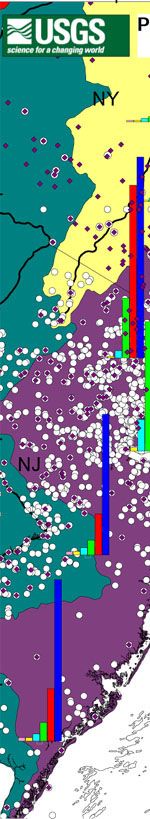
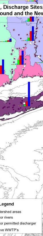
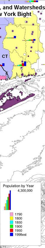
This map shows population growth by county (or combinations of counties near New York City and in New Jersey) from approximately 1790 to the 1998 estimate for 2000. The histograms are plotted in 50-year increments with the largest y-axis representing 4.3 million people (University of Virginia Library and U.S. Census). Major permitted dischargers and active wastewater treatment plants, as well as major watersheds are also shown.
 |
 |
 |
 |
