Open-File Report 03-271
ARCHIVE OF CHIRP SEISMIC REFLECTION DATA
COLLECTED DURING USGS CRUISES 01SCC01
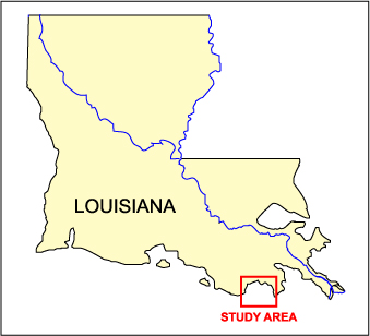
AND 01SCC02, TIMBALIER BAY AND OFFSHORE
EAST TIMBALIER ISLAND, LOUISIANA,
JUNE 30 - JULY 9 AND AUGUST 1 - 12, 2001
by Karynna Calderon, Shawn V. Dadisman, James G. Flocks, Dana S. Wiese, and Jack L. Kindinger
U.S. Geological Survey Open-File Report 03-271
|
DISC 1 OF 4
CONTENTS: |
|||||
 |
|||||
|
This DVD archive presents unprocessed SEG-Y
data files, processed seismic profiles, associated navigation files, trackline maps, logbooks, and formal metadata for chirp data collected on USGS Cruises 01SCC01 and 01SCC02. SEG-Y DATA FILES |
|||||
U.S. GEOLOGICAL SURVEY
CENTER FOR COASTAL AND WATERSHED STUDIES
600 FOURTH STREET SOUTH
ST. PETERSBURG, FL 33701
http://coastal.er.usgs.gov

![]() U.S. Department of the Interior |
U.S. Geological Survey
U.S. Department of the Interior |
U.S. Geological Survey
URL: http://pubsdata.usgs.gov/pubs/of/2003/of03-271/index.htm
Page Contact Information: Publishing Services
Page Last Modified: Sunday, 13-Jan-2013 00:56:58 EST
