USGS OFR 03-346
Online only
Version 1.0
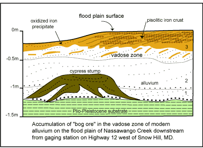
Figure 4a. Cross section of stratigraphic details of Nassawango Creek flood plain
alluvium down stream from gaging station (see fig.2)
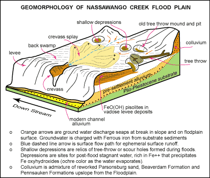
Figure 4b. Schematic diagram of geomorphology of flood plain along Nassawango
Creek where bog iron deposits occur.
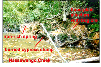
Figure 4c. Exposure of Nassawango Creek flood plain stratigraphy during extended period
of near record low flow (July-September, 1999). Bank is about 1m high. Normal discharge during
late summer low flow would produce 0.5m stage height higher than shown. Discharge during late
winter to early spring commonly covers entrire floodplain. Details of stratigraphy are shown in
Figures 4a and 4b.
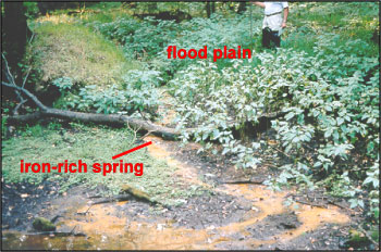
Figure 4d. Iron-rich groundwater discharge form spring on Nassawango Creek floodplain.
Groundwater discharge from springs is charged with Fe++ that oxidizes and precipitates
as colloidal iron oxyhydroxide.
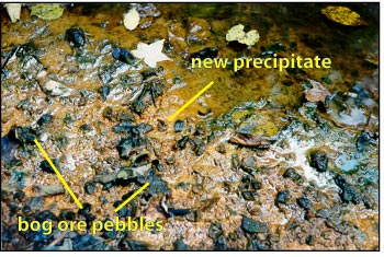
Figure 4e. Alluvium at water's edge of Nassawango Creek during period of low flow shows angular, platy pebbles to 2cm of goethite-limonite eroded from cemented bars and levees of floodplain. Orange "mud" is newly precepitated iron oxyhydroxide. Sweet gum leaf at top of photo is about 6cm wide.
[an error occurred while processing this directive]