Skip past header information USGS Logo with link to USGS web page
Coastal Vulnerability Assessment of FIIS, USGS Open-File Report 03-439


Back to Figure 14


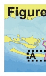
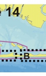
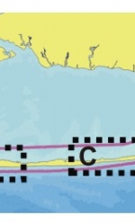
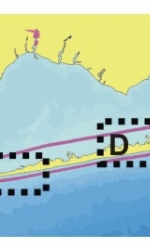
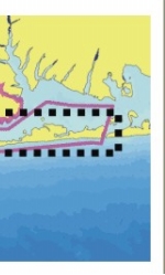
Figure 14. Historic shoreline positions from 1830,1870,1962, 1979,1983, and 2001 at A) Fire Island Lighthouse and Visitors Center, B) Sailors Haven Visitors Center, C) Talisman/Barrett Beach, D) Otis Pike Wilderness Area (Old Inlet sections), and E) Smith Point County Park.


Skip Footer Information
Department of Interior
 /  U.S. Geological Survey  /  Coastal and Marine Geology / 

USGS Privacy Statement  /  Disclaimer  /  Accessibility
This is http://pubs.usgs.gov/pubs/of/2003/of03-439/html/fig14abcde.html
Maintained by Eastern Publications Group
Modified Saturday, 12-Jan-2013 23:44:15 EST