
Coastal Vulnerability Assessment of FIIS, USGS Open-File Report 03-439
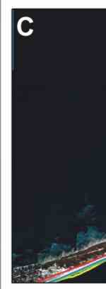
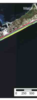
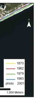
Figure 14C. Historic shoreline positions from 1830,1870,1962, 1979,1983, and 2001 at Talisman/Barrett Beach. | ||||||
|


|
Coastal Vulnerability Assessment of FIIS, USGS Open-File Report 03-439
|