Click on each figure below to zoom to a larger image.
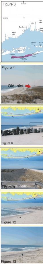
Figure 3. Historical Inlet locations along Fire Island (after Leatherman and Joneja, 1980).
Figure 4: A number of historic inlets are recorded along Fire Island, especially east of Watch Hill. This is a view of Old Inlet, which was open until 1857. See Figure 3 for other former inlet locations.
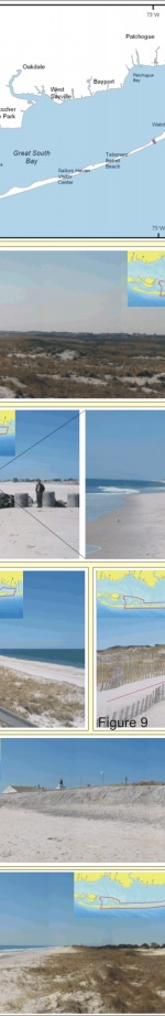
Figure 5: A large sand bar welding to the beach at Robert Moses State Park. This is a high vulnerability area.
Figure 6: The groin at Robins Rest has resulted in downdrift erosion of the beach. Notice the change in elevation from the updrift side of the groin to the downdrift.
Figure 7: Blue Point Beach is in the high vulnerability portion of Fire Island, however, the beach is very narrow and the dunes are heavily scarped in this area.
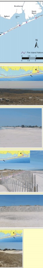
Figure 8: Frontal dune at Watch Hill Visitor Center. The beach is relatively narrow, but the dune is well vegetated and is migrating naturally. This area is located near
the transition from high geomorphologic vulnerability to very high.
Figure 9: Artificial frontal dune created after a renourishment project at Fire Island Pines. Notice the location of the natural dune versus the artificial dune. Property owners
are trying to maintain an older shoreline location.
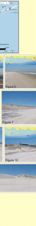
Figure 10: Scarped dunes at Davis Park. Notice the staircases that were left in during the winter.
Figure 11: Large dune scarp within Otis Pike Wilderness area (very high geomorphologic vulnerability).
Figure 12: Dune built with dredged material in front of the pavilion at Smith Point County Park. This area has been
experiencing severe erosion (very high geomorphologic vulnerability).
Figure 13: Very low elevation dunes behind a narrow beach at Smith Point County Park (very high geomorphologic vulnerability).
|