
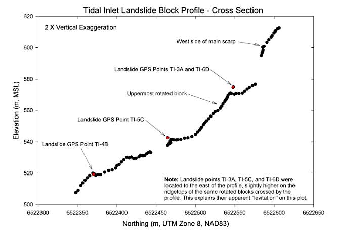
Figure 13 A)-- Profile from hand-held GPS with locations of permanent
GPS monitoring stations (red dots) on upper portion of landslide. Irregular surface
profile
is indicative of movement of multiple rotational blocks within landslide mass.
Link to Figure 13 B.